Town of Cottesloe

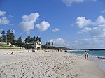
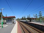
The Town of Cottesloe is a local government area in the western suburbs of Perth, the capital of Western Australia. It covers the suburb of the same name as well as a tiny portion of the suburb of Claremont. Cottesloe is located 11 kilometres (7 mi) west of Perth's central business district, covers an area of 3.9 square kilometres (1.5 sq mi), maintains 45.7 km of roads and had a population of approximately 7,500 as at the 2016 Census. Cottesloe is served by Swanbourne, Victoria Street, Grant Street and Cottesloe train stations, all operated through the Fremantle Railway Line. Various bus routes operate along Stirling Highway, enabling transport through the suburb's western and eastern precincts with Perth and Fremantle. All services are operated by the Public Transport Authority. The Town of Cottesloe's inclusion of walk and cycle paths enable it to be a walkable precinct.
Excerpt from the Wikipedia article Town of Cottesloe (License: CC BY-SA 3.0, Authors, Images).Town of Cottesloe
Napier Street,
Geographical coordinates (GPS) Address Nearby Places Show on map
Geographical coordinates (GPS)
| Latitude | Longitude |
|---|---|
| N -31.993 ° | E 115.757 ° |
Address
Napier Street 27
6011 , Cottesloe
Western Australia, Australia
Open on Google Maps


