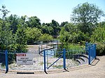
Stirchley and Brookside

Stirchley and Brookside is a civil parish in the Telford and Wrekin unitary authority area of the ceremonial county of Shropshire, England. The parish lies to the south of central Telford, and includes the settlements of Stirchley and Brookside. In 2021 the parish had a population of 10,446. The parish was formed on 1 April 1988. It has a parish council, the lowest level of local government in England. This is made up of seven councillors for Stirchley ward, five councillors for Brookside ward, and one for Holmer Lake ward. There is one grade I listed building in the parish, the redundant 12th-century St James' Church, Stirchley. As of 2024 there are four other listed buildings in the parish, all at grade II.
Excerpt from the Wikipedia article Stirchley and Brookside (License: CC BY-SA 3.0, Authors, Images).Stirchley and Brookside
Tadorna Drive,
Geographical coordinates (GPS) Address Nearby Places Show on map
Geographical coordinates (GPS)
| Latitude | Longitude |
|---|---|
| N 52.652 ° | E -2.435 ° |
Address
Tadorna Drive
Tadorna Drive
TF3 1QP , Brookside
England, United Kingdom
Open on Google Maps


