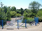
Stirchley, Shropshire

Stirchley is a large village and suburb of Telford, in the borough of Telford and Wrekin and ceremonial county of Shropshire, England. Stirchley lies just south-east of the town centre, and shares a parish council with neighbouring Brookside, which together have a population of 10,533 according to the 2001 census data It is close to Dawley and Malinslee and located next to the southern side of Telford town park. Although formerly a farming parish, it was incorporated into the Telford New Town in the 1970s. There are some important heritage sites in the parish, notably St James Church, Stirchley Hall, Stirchley Grange and the Stirchley Chimney, now a local landmark. A number of Stirchley's heritage sites are waypoints on the South Telford Heritage Trail. The former school was removed brick-by-brick and rebuilt at the nearby Blists Hill Victorian Town museum in 1993.
Excerpt from the Wikipedia article Stirchley, Shropshire (License: CC BY-SA 3.0, Authors, Images).Stirchley, Shropshire
Grange Close,
Geographical coordinates (GPS) Address Website Nearby Places Show on map
Geographical coordinates (GPS)
| Latitude | Longitude |
|---|---|
| N 52.6547 ° | E -2.4351 ° |
Address
Co-op Food
Grange Close
TF3 1EX , Stirchley
England, United Kingdom
Open on Google Maps


