Chicopee Falls Dam
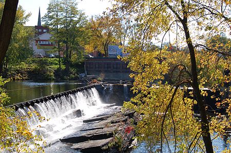
The Chicopee Falls Dam is a masonry stone dam that parallels Route 33 (Bridge Street) in Chicopee, Massachusetts. It is part of the Chicopee River Watershed. The dam was constructed in the late 19th century, and is currently owned by the City of Chicopee. It impounds the waters of the Chicopee River at Chicopee Falls, to form the Chicopee Reservoir. This is the third-to-last dam on the Chicopee River before it empties into the Connecticut River just north of Springfield.Flash-boards have been installed to raise the level of the impoundment above the original height of the dam. Therefore, the dam's effective height is greater than the 10 feet (3.05 m) shown in its specifications.
Excerpt from the Wikipedia article Chicopee Falls Dam (License: CC BY-SA 3.0, Authors, Images).Chicopee Falls Dam
Montgomery Street, Chicopee
Geographical coordinates (GPS) Address Nearby Places Show on map
Geographical coordinates (GPS)
| Latitude | Longitude |
|---|---|
| N 42.16 ° | E -72.580972222222 ° |
Address
Montgomery Street 8
01020 Chicopee
Massachusetts, United States
Open on Google Maps
