place

Crete Senesi

Crete SenesiGeography of TuscanyProvince of SienaProvince of Siena geography stubs
Crete Senesi Monte Oliveto

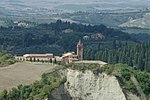
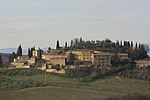
The Crete Senesi refers to an area of the Italian region of Tuscany immediately to the south of Siena. It consists of a range of hills and woods among villages and includes the comuni of Asciano, Buonconvento, Monteroni d'Arbia, Rapolano Terme and San Giovanni d'Asso, all within the province of Siena. They border to the north with the Chianti Senese area, to the east with Val di Chiana and to the south-west with Val d'Orcia. Nearby is also the semi-arid area known as the Accona Desert. Crete Senesi are literally the "clays of Siena": the distinctive grey colouration of the soil gives the landscape an appearance often described as lunar. This characteristic clay, known as mattaione, represents the sediments of the Pliocene sea which covered the area between 2.5 and 4.5 million years ago. The landscape is characterized by barren and gently undulating hills, solitary oaks and cypresses, isolated farms at the top of the heights, stretches of wood and ponds of rainwater (commonly referred as fontoni, literally "big springs") in the valleys. Badlands and biancane are typical conformations of the land. Perhaps the most notable edifice of this area is the Abbey of Monte Oliveto Maggiore, located 10 km south of Asciano. The region is known for its production of white truffles, and hosts a festival and a museum dedicated to the rare fungus (genus Tuber).

Excerpt from the Wikipedia article Crete Senesi (License: CC BY-SA 3.0, Authors, Images).

Crete Senesi
Strada Provinciale del Pecorile,

Geographical coordinates (GPS) Address Nearby Places
placeShow on map

Wikipedia: Crete SenesiContinue reading on Wikipedia

Geographical coordinates (GPS)

Latitude Longitude
N 43.2 ° E 11.566666666667 °
placeShow on map

Address

Strada Provinciale del Pecorile
53041
Tuscany, Italy
mapOpen on Google Maps

Crete Senesi Monte Oliveto
Share experience

Nearby Places

Accona Desert
Accona Desert

The Accona Desert refers to a hilly area in the Siena province of Italy, within the municipality of Asciano [43°14'4.30"N; 11°33'37.48"E]. The term is often used to include the Biancana site of Le Fiorentine - Leonina [ 43°17'32.95”N; 11°26'54.07"E]. Despite its name, its climate is Mediterranean, with a hot, dry summer and almost 800 mm/y of rain (Csa Köppen climate classification). A real desert has never existed here. However, there have been temporarily severely eroded areas, more properly called "badlands". Two main types of badlands can be found in the area of the Crete Senesi, the Valdorcia, and the Volterra areas of Tuscany: Biancana (from Bianco, white, due to the light color of the clay and of the saline efflorescence) and calanco (local name for a type of gully or ravine). Both are linked to gully erosion processes, the former intermingled mainly with subsurface erosion and the latter with mass movements. Biancanas can also be found in Basilicata and in Calabria. The calanco landscape is common all along the Apennines and in many parts of the Alps. Both calancos and biancanas were used as grazing ground, with an almost annual burning of the vegetation to remove brush and favor herbaceous cover more palatable for sheep, goats, and cattle. Both practices were abandoned in the 1990s to favor measures to preserve biodiversity and geo forms under the EU Natura 2000 program. Conservation has almost stopped erosion in both types of badlands and vegetation now covers the majority of the area that was once bare slopes. As there is a strong interrelationship between vegetation biodiversity and erosion/deposition processes, biodiversity is also threatened and the biancana landscape is forecast to disappear entirely within 20-40 years as brush cover expands. Spots where the traditional forms can still be observed are scattered in the Crete Senesi and the Valdorcia, included within the quadrangle of vertices [43°16'10.58"N ; 11°15'59.30”E], [43°18'28.68”N; 11°39'4.92”E], [42°43'32.58”N; 11°42'22.98”E], [42°45'49.22”N; 11°58'41.90”E]. Leonina and Lucciola Bella [43° 2'4.85"N; 11°45'35.75"E] are two of the best sites for walking through the biancanas, while Chiusure - Monte Oliveto Maggiore (i.e., the ancient Accona) and Radicofani [42°55'8.14"N; 11°44'38.82"E] host the most impressive calancos.