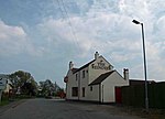
Stockholes Turbary
Commons category link is defined as the pagenameHamlets in LincolnshireUse British English from October 2014Villages in the Borough of North Lincolnshire

Stockholes Turbary is a hamlet and nature reserve on the Isle of Axholme in the parish of Belton in North Lincolnshire unitary area of Lincolnshire, England. It is also close to the former Sandtoft Airfield and the village of Westgate.
Excerpt from the Wikipedia article Stockholes Turbary (License: CC BY-SA 3.0, Authors, Images).Stockholes Turbary
Sandtoft Road,
Geographical coordinates (GPS) Address Nearby Places Show on map
Geographical coordinates (GPS)
| Latitude | Longitude |
|---|---|
| N 53.5571 ° | E -0.8495 ° |
Address
Sandtoft Road
DN9 1PH
England, United Kingdom
Open on Google Maps


