Victoria Park, Western Australia
Suburbs in the Town of Victoria ParkSuburbs of Perth, Western AustraliaUse Australian English from March 2014Victoria Park, Western Australia

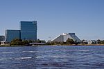
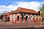
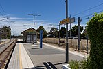
Victoria Park is an inner south eastern suburb of Perth, Western Australia. Its local government area is the Town of Victoria Park. Victoria Park is the eastern gateway to Perth's central business district (CBD), being the intersection of the three original eastern arterial roads: Albany Highway, Canning Highway, Great Eastern Highway, and the Causeway bridge. The Causeway connects Victoria Park to the city, located 3 kilometres (2 mi) to the northwest.
Excerpt from the Wikipedia article Victoria Park, Western Australia (License: CC BY-SA 3.0, Authors, Images).Victoria Park, Western Australia
Rushton Street,
Geographical coordinates (GPS) Address Nearby Places Show on map
Geographical coordinates (GPS)
| Latitude | Longitude |
|---|---|
| N -31.969 ° | E 115.896 ° |
Address
Rushton Street
Rushton Street
6100 , Burswood
Western Australia, Australia
Open on Google Maps


