place

Konstanz-Wollmatingen station

Buildings and structures in Konstanz (district)Pages with no open date in Infobox stationRailway stations in Baden-Württemberg
Bahnhof Konstanz Wollmatingen Seehas

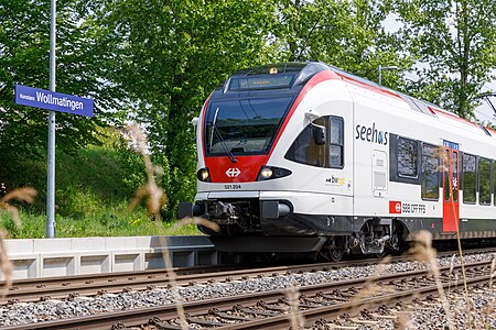
Konstanz-Wollmatingen station (German: Bahnhof Konstanz-Wollmatingen) is a railway station in the city of Konstanz, Baden-Württemberg, Germany. It is located on the standard gauge High Rhine Railway of Deutsche Bahn and served by regional trains only.

Excerpt from the Wikipedia article Konstanz-Wollmatingen station (License: CC BY-SA 3.0, Authors, Images).

Konstanz-Wollmatingen station
Riedstraße, Verwaltungsgemeinschaft Konstanz

Geographical coordinates (GPS) Address Nearby Places
placeShow on map

Wikipedia: Konstanz-Wollmatingen stationContinue reading on Wikipedia

Geographical coordinates (GPS)

Latitude Longitude
N 47.682453055556 ° E 9.1473311111111 °
placeShow on map

Address

Riedstraße

Riedstraße
78467 Verwaltungsgemeinschaft Konstanz, Konstanz-Industriegebiet
Baden-Württemberg, Germany
mapOpen on Google Maps

Bahnhof Konstanz Wollmatingen Seehas
Share experience

Nearby Places

Paradies, Konstanz
Paradies, Konstanz

Paradies (literally: "paradise") is a former village, now a quarter of Konstanz, Germany. The district is located west of the Old Town on the southern shore of the Seerhein; with an area of about 63.2 hectare (632,034 m2 (6,803,160 sq ft), to be exact) and 6176 inhabitants (2007 census). In the Late Middle Ages, it was a fishing and farming village called Eggehusen. Its original centre was the St Leonard's Chapel erected in the 14th century at the site of a former Poor Clares monastery with the name claustrum Paradysi apud Constantiam founded in 1186. In 1253 the nuns left their convent on the outskirts of Konstanz and moved to Schlatt near Schaffhausen; while the name Paradies stuck. The chapel was rebuilt in 1921, it today is consecrated to St Martin. In 1610, about 300 people were living in Paradies. The farmers in Paradies supplied the inhabitants of the city from their fields on the open space between the current federal road B 33 (Europe Street) and the city walls. Paradies then was a separate municipality. In 1639, the City of Konstanz created a new defensive earth wall and ditch (the Saubach); Paradies was included inside this perimeter. The Paradies part of the structure included two towers, the Grießeggturm at the Gottlieber customs post, and one small castle named Paradieser Schlössle. With the loss of arable land between Paradies and Konstanz, cultivation of vegetables shifted to the Tägermoos area west of Paradies, which was owned by the city of Konstanz, but was administratively in the Swiss canton of Thurgau. When the city of Constance stopped operating a municipal bull stable, Paradies started its own. By 1880 the population had risen to nearly 1500. Today the number of farmers growing vegetables is steadily declining. In 1969, there were 25 of them in Paradies; in 2006 there were only eight. The last cattle farmer ceased operations in 1994. Until the summer of 2004, the municipal bus route No. 10 went from the city's cemetery to Paradies. Buses named Friedhof—Paradies ("Cemetery—Paradise") were often photographed.
Triboldingerbohl
Triboldingerbohl

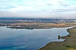
Triboldingerbohl, also known as Triboltingen or großes Bohl or Langenrain, is the fourth largest island of Lake Constance, with an area of 0.13557 square kilometres (0.05234 sq mi). It is 780 meters (2,560 ft) long and up to 230 meters (750 ft) wide. It is located in the easternmost part of the Untersee (Lake Constance), near the point where the Seerhein flows into the lake. This part of the lake is also known as the Rheinsee. It belongs to the Wollmatinger Ried nature conservation area; administratively it belongs to the district industrial area of the City of Constance. Until 1934, it belonged to the municipality of Wollmatingen, which was then annexed by Constance. Triboldingerbohl lies 2.1 km (1.3 mi) southeast of Reichenau Island and 1.6 km (0.99 mi) from the dam that connects Reichenau to the mainland. The area between Triboldingerbohl island and the Reichenau dam is called Ermatinger pool and is an ecologically important shallow-water zone. Triboldingerbohl is uninhabited. It is a bird sanctuary. It takes its name from the former Swiss municipality Triboltingen, which was located on the southern shore of Lake Untersee. Between Triboldingerbohl and the mainland lies the smaller island of Mittler Bohl, also known as Langbohl. The two islands are separated by a channel which is only 30 to 50 meters (98 to 164 ft) wide. This channel and the channel separating Langbohl from the mainland are collectively known as Schläuche ("tubes"). Both island are covered with reeds. They consist of a several meters thick layer of Schnegglisand, a calcareous deposits from Blue-green algae), which is covered by a layer of humus. Although the island is uninhabited, it is listed in the Constance street directory. It falls under postal code 78467 (Constance-Wollmatingen).