place

Seerhein

Geography of Lake ConstanceRhineRivers of Baden-WürttembergRivers of GermanyRivers of Switzerland
Rivers of Thurgau
Seerhein 02
Seerhein 02

The Seerhein (lit. 'Lake Rhine') is a river about four kilometres long, in the basin of Lake Constance. It is the outflow of the Upper Lake Constance and the main tributary of the Lower Lake Constance. The water level of the lower lake is about 30 cm below the level of the Upper Lake. It is considered part of the Rhine, which flows into Lake Constance as the Alpine Rhine and flows out of the Lake as the High Rhine. The Seerhein arose after the last ice age (the Würm glaciation, about 9650 BCE). Some time after this period, the water level of Lake Constance gradually dropped by about ten metres and the shallow parts fell dry. Some parts of the Seerhein still have a character a bit like a lake. The border between Germany and Switzerland runs down the center of the lower stretch of the river; the German city of Constance, the largest community on the river, is situated on both sides of the upper part.

Excerpt from the Wikipedia article Seerhein (License: CC BY-SA 3.0, Authors, Images).

Seerhein
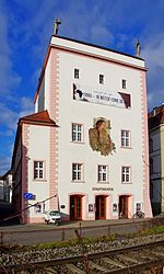
Am Rheinufer, Verwaltungsgemeinschaft Konstanz

Geographical coordinates (GPS) Address Nearby Places
placeShow on map

Wikipedia: SeerheinContinue reading on Wikipedia

Geographical coordinates (GPS)

Latitude Longitude
N 47.67 ° E 9.17 °
placeShow on map

Address

Am Rheinufer
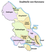
78467 Verwaltungsgemeinschaft Konstanz, Konstanz-Petershausen-West
Baden-Württemberg, Germany
mapOpen on Google Maps

Seerhein 02
Seerhein 02
Share experience

Nearby Places

Council of Constance

The Council of Constance (Latin: Concilium Constantiense; German: Konzil von Konstanz) was an ecumenical council of the Catholic Church that was held from 1414 to 1418 in the Bishopric of Constance (Konstanz) in present-day Germany. The council ended the Western Schism by deposing or accepting the resignation of the remaining papal claimants and by electing Pope Martin V. It was the last papal election to take place outside of Italy. The council also condemned Jan Hus as a heretic and facilitated his execution by the civil authority, and ruled on issues of national sovereignty, the rights of pagans and just war, in response to a conflict between the Grand Duchy of Lithuania, the Kingdom of Poland and the Order of the Teutonic Knights. The council is also important for its role in the debates over ecclesial conciliarism and papal supremacy. Constance issued two particularly significant decrees regarding the constitution of the Catholic Church: Haec sancta (1415), which asserted the superiority of ecumenical councils over popes in at least certain situations, and Frequens (1417), which provided for councils to be held automatically every ten years. The status of these decrees proved controversial in the centuries after the council, and Frequens was never put into practice. Though Haec sancta, at least, continued to be accepted as binding by much of the church up to the 19th century, present-day Catholic theologians generally regard these decrees as either invalid or as practical responses to a particular situation without wider implications.

Paradies, Konstanz
Paradies, Konstanz

Paradies (literally: "paradise") is a former village, now a quarter of Konstanz, Germany. The district is located west of the Old Town on the southern shore of the Seerhein; with an area of about 63.2 hectare (632,034 m2 (6,803,160 sq ft), to be exact) and 6176 inhabitants (2007 census). In the Late Middle Ages, it was a fishing and farming village called Eggehusen. Its original centre was the St Leonard's Chapel erected in the 14th century at the site of a former Poor Clares monastery with the name claustrum Paradysi apud Constantiam founded in 1186. In 1253 the nuns left their convent on the outskirts of Konstanz and moved to Schlatt near Schaffhausen; while the name Paradies stuck. The chapel was rebuilt in 1921, it today is consecrated to St Martin. In 1610, about 300 people were living in Paradies. The farmers in Paradies supplied the inhabitants of the city from their fields on the open space between the current federal road B 33 (Europe Street) and the city walls. Paradies then was a separate municipality. In 1639, the City of Konstanz created a new defensive earth wall and ditch (the Saubach); Paradies was included inside this perimeter. The Paradies part of the structure included two towers, the Grießeggturm at the Gottlieber customs post, and one small castle named Paradieser Schlössle. With the loss of arable land between Paradies and Konstanz, cultivation of vegetables shifted to the Tägermoos area west of Paradies, which was owned by the city of Konstanz, but was administratively in the Swiss canton of Thurgau. When the city of Constance stopped operating a municipal bull stable, Paradies started its own. By 1880 the population had risen to nearly 1500. Today the number of farmers growing vegetables is steadily declining. In 1969, there were 25 of them in Paradies; in 2006 there were only eight. The last cattle farmer ceased operations in 1994. Until the summer of 2004, the municipal bus route No. 10 went from the city's cemetery to Paradies. Buses named Friedhof—Paradies ("Cemetery—Paradise") were often photographed.