place

Barlow Church

Church of England church buildings in North YorkshireFormer churches in North YorkshireGrade II listed churches in North YorkshireUse British English from June 2024
Barlow Church geograph.org.uk 118500

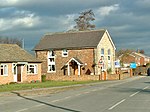
Barlow Church is a former parish church in Barlow, North Yorkshire, a village in England. There was a chapel of ease in the village, dependent on St Wilfrid's Church, Brayton, recorded in 1649. The chapel appears to have become disused following the English Restoration, but the current building was constructed before the end of the century. It was restored and altered in 1774, and again in the 19th century. In the 1970s, it was reordered, and more of the interior was given over to the chancel. It was Grade II listed in 1998. The church closed in 2012, and was converted into a house. The three-bay building is constructed of brick, with a pantile roof. There is a small wooden bellcote atop the south gable, with a lead roof and ornate weathervane. The south, west and north facades each have one two-light window, while the east facade has the entrance door and two windows. Before its conversion, there were 19th century pews, and a lectern and altar of similar date, and a brass war memorial plaque dating to about 1920. The Church of England describes it as "a simple, charming building".

Excerpt from the Wikipedia article Barlow Church (License: CC BY-SA 3.0, Authors, Images).

Barlow Church
Brown Cow Road,

Geographical coordinates (GPS) Address Nearby Places
placeShow on map

Wikipedia: Barlow ChurchContinue reading on Wikipedia

Geographical coordinates (GPS)

Latitude Longitude
N 53.75324 ° E -1.02297 °
placeShow on map

Address

Brown Cow Road

Brown Cow Road
YO8 8EL
England, United Kingdom
mapOpen on Google Maps

Barlow Church geograph.org.uk 118500
Share experience

Nearby Places

Drax Power Station
Drax Power Station

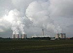
Drax power station is a large biomass power station in Drax, North Yorkshire, England, capable of co-firing petroleum coke. It has a 2.6 GW capacity for biomass and had a 1.29 GW capacity for coal that was retired in 2021. Its name comes from the nearby village of Drax. It is situated on the River Ouse between Selby and Goole. Its generating capacity of 3,906 megawatts (MW), which includes the shut down coal units, is the highest of any power station in the United Kingdom, providing about 6% of the United Kingdom's electricity supply.Opened in 1974 and extended in the 1980s, the station was initially operated by the Central Electricity Generating Board. Since privatisation in 1990 ownership has changed several times, and it is operated by the Drax Group. Completed in 1986, it was the newest coal-fired power station in England until it closed in 2021. Flue gas desulphurisation equipment was fitted between 1988 and 1995. The high and low pressure turbines were replaced between 2007 and 2012. By 2010, the station was co-firing biomass. In 2012, the company announced plans to convert three generating units to solely biomass, burning 7.5 million tonnes imported from the United States and Canada. This work was completed in 2016 and a fourth unit was converted in 2018. The company planned to convert its remaining two coal units to Combined Cycle Gas Turbine units and 200 MW battery storage. However, those two coal units were shut in 2021 without converting them to biomass.