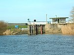
Drax Power Station

Drax power station is a large biomass power station in Drax, North Yorkshire, England, capable of co-firing petroleum coke. It has a 2.6 GW capacity for biomass and had a 1.29 GW capacity for coal that was retired in 2021. Its name comes from the nearby village of Drax. It is situated on the River Ouse between Selby and Goole. Its generating capacity of 3,906 megawatts (MW), which includes the shut down coal units, is the highest of any power station in the United Kingdom, providing about 6% of the United Kingdom's electricity supply.Opened in 1974 and extended in the 1980s, the station was initially operated by the Central Electricity Generating Board. Since privatisation in 1990 ownership has changed several times, and it is operated by the Drax Group. Completed in 1986, it was the newest coal-fired power station in England until it closed in 2021. Flue gas desulphurisation equipment was fitted between 1988 and 1995. The high and low pressure turbines were replaced between 2007 and 2012. By 2010, the station was co-firing biomass. In 2012, the company announced plans to convert three generating units to solely biomass, burning 7.5 million tonnes imported from the United States and Canada. This work was completed in 2016 and a fourth unit was converted in 2018. The company planned to convert its remaining two coal units to Combined Cycle Gas Turbine units and 200 MW battery storage. However, those two coal units were shut in 2021 without converting them to biomass.
Excerpt from the Wikipedia article Drax Power Station (License: CC BY-SA 3.0, Authors, Images).Drax Power Station
A645,
Geographical coordinates (GPS) Address Nearby Places Show on map
Geographical coordinates (GPS)
| Latitude | Longitude |
|---|---|
| N 53.735833333333 ° | E -0.99638888888889 ° |
Address
A645
YO8 8PJ
England, United Kingdom
Open on Google Maps


