place

Tilsworth

Central Bedfordshire DistrictCivil parishes in BedfordshireUse British English from July 2016Villages in Bedfordshire
The Anchor, Tilsworth geograph.org.uk 637861

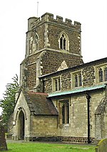
Tilsworth is a small village and civil parish in Bedfordshire. It lies to the north west of Dunstable, and the Roman Watling Street (A5) forms the north east boundary of the parish of 1,200 acres (4.8 km2). The village lies on the gault clay, where springs well up just south of a gentle gravelly ridge. A large proportion of the area is still farmland. The Domesday Book calls the place "Pileworde" because of a misunderstanding of the symbol for "th", and the name probably means "Thyfel's homestead". A further alternative spelling is "Tyllesworth", in a legal record, dated 1470, mentioning Thomas Carter, a husbandman of the village.Stanbridge, a larger village, is a close neighbour to the west and some organisations, such as the Women's Institute, are combined.The medieval All Saints' Church, built of Totternhoe stone, stands in a prominent position on the hillside, and can be seen from a distance when floodlit at night. It has shared a vicar with Stanbridge since the 19th century, and the combined benefice now also includes Totternhoe. The Church House acts as a centre for many local organisations and there is an active community life in the village. The Methodist Church, faced with the need for expensive repairs, was closed in 1990 and demolished.Across the road from the church, on lower ground, is the ancient moated site of Tilsworth Manor (now a private house). The house itself has been much altered in modern times, but retains a picturesque 15th century gate tower. Tilsworth fête is held in the grounds each June. The manor was owned in the 16th century by the Fowler family. In 1600 a notorious trial followed a quarrel between Richard Fowler and his young wife. Richard was imprisoned in the Tower of London as the result of a forged letter implicating him in a plot to poison Queen Elizabeth I. His wife, her brother and her lover were convicted of the forgery.A gravestone in the churchyard, bearing a verse inscription about a "female unknown" found murdered in the nearby woods in 1821, arouses much interest.Several old farmhouses, two of them thatched, survive in Tilsworth. There are new houses and bungalows, but the village has not yet increased greatly in size. One farmhouse in the north corner of the parish was lost to Hockliffe, to which it was adjacent, in the 20th century. The "Little Chef" restaurant and Travelodge on the A5 are called "Hockliffe", though in fact they lie in Tilsworth. A public house, the Anchor, with restaurant and garden, stands next to one of the small greens, and there is a golf and conference centre. Tilsworth is part of the political ward of 'Heath and Reach' which sends a Councillor to Central Bedfordshire Council. The ward includes the villages of Heath and Reach, Hockliffe, Eggington, Stanbridge, Tilsworth, Tebworth and Wingrave. The ward was created in 2011 and has since been represented by Councillor Mark Versallion.

Excerpt from the Wikipedia article Tilsworth (License: CC BY-SA 3.0, Authors, Images).

Tilsworth
Stanbridge Road,

Geographical coordinates (GPS) Address Nearby Places
placeShow on map

Wikipedia: TilsworthContinue reading on Wikipedia

Geographical coordinates (GPS)

Latitude Longitude
N 51.9096 ° E -0.5783 °
placeShow on map

Address

Stanbridge Road

Stanbridge Road
LU7 9PW
England, United Kingdom
mapOpen on Google Maps

The Anchor, Tilsworth geograph.org.uk 637861
Share experience

Nearby Places

Stanbridge, Bedfordshire

Stanbridge is a village and civil parish in Bedfordshire which lies 3 miles (5 km) east of Leighton Buzzard. It also borders the Bedfordshire villages of Hockliffe, Eggington, Tilsworth, Totternhoe and Billington. There was a windmill to the east of Mill Road, in the north of the village, that is marked on early Ordnance Survey maps. To the west of Mill Road, still standing, is a later windmill that has been converted to a three-story house. This has recently had a new dome fitted to its roof. St John the Baptist Parish Church is also located in the village. Stanbridge had its own railway station, until it was closed in the 1960s by Lord Beeching. This was to the south of the village, at Stanbridgeford on the Leighton Buzzard to Dunstable LNWR line. The eastern part of the old line has been utilised as a footpath to Sewell and Dunstable; the western part is now part of the Leighton Buzzard Southern Bypass. RAF Stanbridge was built on land that was in the neighbouring parish of Billington, but the town of Leighton Buzzard has now expanded over much of the base. The village has a traditional English country public house called The Five Bells. Stanbridge is part of the political ward of 'Heath and Reach' which sends a Councillor to Central Bedfordshire Council. The ward includes the villages of Heath and Reach, Hockliffe, Eggington, Stanbridge, Tilsworth, Tebworth, and Wingrave. The ward was created in 2011 and has since been represented by Councillor Mark Versallion.

Totternhoe Knolls
Totternhoe Knolls

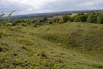
Totternhoe Knolls is a 13.1-hectare (32-acre) Site of Special Scientific Interest (SSSI) in Totternhoe in Bedfordshire. It is also a local nature reserve, and part of the Chilterns Area of Outstanding Natural Beauty. The site is owned by Central Bedfordshire Council and leased to the National Trust. Most of the site is maintained jointly by the National Trust and the Wildlife Trust for Bedfordshire, Cambridgeshire and Northamptonshire (WTBCN), and is part of the WTBCN Totternhoe nature reserve, which also includes Totternhoe Chalk Quarry and Totternhoe Stone Pit. The SSSI also includes Totternhoe Castle, the earthworks of a Norman motte-and-bailey castle which is a Scheduled monument. Part of the site was formerly a quarry where Totternhoe Stone, a strong type of chalk that was used in Westminster Abbey, was mined. This part is now grassland with a rich variety of plant species, including some that are now rare; these are characteristic species of chalk downland and include kidney vetch, horseshoe vetch, large thyme, squinancywort, autumn gentian, clustered bellflower, sainfoin and dwarf thistle. Orchids that grow here include common spotted orchid, Herminium monorchis Musk orchid, Orchis anthropophora Man orchid, bee orchid and twayblade . There are a wide variety of invertebrates, including butterflies such as the common blue, the chalkhill blue, and the scarce small blue and Duke of Burgundy fritillary.Totternhoe Castle was probably built in the late eleventh century. Only the earthworks survive, with a mound five metres tall and 40 metres wide. It is unusual in having three baileys.There is access from the National Trust car park off Castle Hill Road.