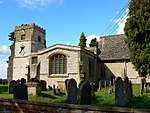
Denchworth
Civil parishes in OxfordshireUse British English from August 2015Villages in Oxfordshire

Denchworth is a village and civil parish about 2.5 miles (4 km) north of Wantage. It was part of Berkshire until the 1974 boundary changes transferred the Vale of White Horse to Oxfordshire. The 2011 Census recorded the parish's population as 171. The parish is bounded by the Land Brook in the west and the Childrey Brook in the east. The Great Western Main Line between Reading and Swindon runs through the parish just south of the village, but there is no station.
Excerpt from the Wikipedia article Denchworth (License: CC BY-SA 3.0, Authors, Images).Denchworth
Hyde Road, Vale of White Horse
Geographical coordinates (GPS) Address Nearby Places Show on map
Geographical coordinates (GPS)
| Latitude | Longitude |
|---|---|
| N 51.623 ° | E -1.451 ° |
Address
Saint James
Hyde Road
OX12 0DX Vale of White Horse
England, United Kingdom
Open on Google Maps


