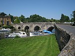
Maidstone Rural District
Borough of MaidstoneDistricts of England abolished by the Local Government Act 1972Districts of England created by the Local Government Act 1894History of KentRural districts of England ... and 1 more
Use British English from November 2023
Maidstone Rural District was a rural district in the county of Kent, England. It lay to the south of the town and municipal borough of Maidstone. Following the Local Government Act 1972, on 1 April 1974 the district was merged with the municipal borough and Hollingbourne Rural District to form the Borough of Maidstone.
Excerpt from the Wikipedia article Maidstone Rural District (License: CC BY-SA 3.0, Authors).Maidstone Rural District
Hunton Hill,
Geographical coordinates (GPS) Address Nearby Places Show on map
Geographical coordinates (GPS)
| Latitude | Longitude |
|---|---|
| N 51.233333333333 ° | E 0.48333333333333 ° |
Address
Hunton Hill
Hunton Hill
ME15 0PX , Coxheath
England, United Kingdom
Open on Google Maps


