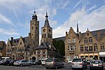
Stuivekenskerke
Populated places in West FlandersSub-municipalities of Diksmuide

Stuivekenskerke is a district of the town of Diksmuide, in the Belgian province of West Flanders. Located on the Yser river, until 1970 it was an independent municipality and then merged and became a sub-municipality of Diksmuide. Stuivekenskerke, built in a polder, has an area of 7.34 km2 and had 160 inhabitants in 2007.
Excerpt from the Wikipedia article Stuivekenskerke (License: CC BY-SA 3.0, Authors, Images).Stuivekenskerke
Stuivekenskerkestraat,
Geographical coordinates (GPS) Address Nearby Places Show on map
Geographical coordinates (GPS)
| Latitude | Longitude |
|---|---|
| N 51.083333333333 ° | E 2.8166666666667 ° |
Address
Stuivekenskerkestraat
Stuivekenskerkestraat
8600 (Stuivekenskerke)
West Flanders, Belgium
Open on Google Maps


