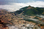
Jaraguá State Park

Jaraguá State Park (English: Parque Estadual do Jaraguá) is a preservation area located in the state of São Paulo, Brazil. It was created in 1961 in the Serra da Cantareira, around the Jaraguá Peak, the highest point in the municipality of São Paulo with an altitude of 1,135 meters.The park includes Afonso Sardinha's house, listed as a historical heritage site, and the place where slaves washed the gold they found in the region. There are three trails with total contact with nature. It is also possible to meet a tribe of indigenous people who still live there today.Covering an area of 492 hectares, the park is located in the northwest of the city of São Paulo, where the Tropic of Capricorn passes by. Its main attraction is the Jaraguá Peak, which in Tupi means "lord of the valley". Due to its magnificence, it is a reference point for those arriving in or leaving the capital via the Anhanguera-Bandeirantes road system.The park is considered one of the last remnants of the Atlantic Forest in the Greater São Paulo region. Due to its proximity to urban areas, this biome is among the most vulnerable on the planet. Located more precisely in the Jaraguá district, its borders are the Perus and Pirituba districts and the municipality of Osasco.
Excerpt from the Wikipedia article Jaraguá State Park (License: CC BY-SA 3.0, Authors, Images).Jaraguá State Park
Estrada Turística do Jaraguá, São Paulo
Geographical coordinates (GPS) Address Nearby Places Show on map
Geographical coordinates (GPS)
| Latitude | Longitude |
|---|---|
| N -23.459527777778 ° | E -46.767444444444 ° |
Address
Estrada Turística do Jaraguá
05176-240 São Paulo (Jaraguá)
São Paulo, Brazil
Open on Google Maps


