place

Little Chebeague Island

Commons category link is defined as the pagenameIslands of Casco BayIslands of Cumberland County, MaineIslands of MainePortland metropolitan area, Maine
Uninhabited islands
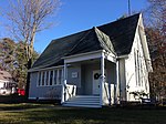
Fleet Recreation Center, Little Chebeague Island, Casco Bay Portland, ME DPLA b8ec8ed2c5f5a43707f8916b02c1a818

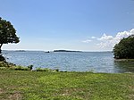
Little Chebeague Island is an uninhabited island in Casco Bay, an inlet of the Gulf of Maine, United States. It is located around 0.85 miles (1.37 km) west of the southern tip of the larger Great Chebeague Island. As its name implies, the two are connected—by a sand bar which appears at low tide.The island, which was the home of the Wabanaki people, is co-managed by the Maine Bureau of Parks and Lands (BPL) and the Maine Island Trail Association (MITA) as an undeveloped park where picnicking, camping and swimming are permitted.Being that there are many fresh-water underground springs and rivulets, low-tide exposed sandy areas, such as the sandbar or coves, often have "quicksand" zones that must be noted with caution. The island, which is approximately 0.75 miles (1.21 km) long (east to west) and 0.40 miles (0.64 km) wide (north to south), with 86 acres (35 ha) of land, is mostly dense shrub and forest, having been allowed to grow wild between the end of World War II and the late 20th century. The island now contains around 1.5 miles (2.4 km) of hiking trails, which pass the remains of several former summer cottages.

Excerpt from the Wikipedia article Little Chebeague Island (License: CC BY-SA 3.0, Authors, Images).

Little Chebeague Island
Cliff's Passage,

Geographical coordinates (GPS) Address Nearby Places
placeShow on map

Wikipedia: Little Chebeague IslandContinue reading on Wikipedia

Geographical coordinates (GPS)

Latitude Longitude
N 43.712137 ° E -70.148442 °
placeShow on map

Address

Cliff's Passage
04017
Maine, United States
mapOpen on Google Maps

Fleet Recreation Center, Little Chebeague Island, Casco Bay Portland, ME DPLA b8ec8ed2c5f5a43707f8916b02c1a818
Share experience

Nearby Places

Chebeague Island
Chebeague Island

Chebeague Island is located in Casco Bay, an inlet of the Gulf of Maine. It was originally used as a fishing ground by Abenaki Native Americans. Also known as Great Chebeague (pronounced "sha-big") Island, today it is a town in Cumberland County, Maine, United States. It is located 10 miles (16 km) northeast of Portland, Maine. Chebeague Island is the largest island in Casco Bay that is not connected to the mainland by a bridge. The largest island is Sebascodegan, or "Great Island," which is part of the Town of Harpswell and connected to the mainland via a 100ft bridge. Chebeague Island is one of the twelve major islands of the Calendar Islands, a term that originated in 1700 with the report by the English military engineer Wolfgang William Römer, who claimed there were "as many islands as there are days in the year." As a corrective, the Maine State Historian Robert M. York stated there are "little more than two hundred islands" in Casco Bay.Chebeague Island was a part of the Town of Cumberland until July 1, 2007, when it seceded and became the Town of Chebeague Island. The Town of Chebeague Island includes seventeen islands and their adjacent waters. These include the islands of Bangs, Bates, Hope, Ministerial, Sand, Stave, Stockman, and the tiny Upper Green Islands. At the 2020 census, the town's year-round population was 396. The population is said to more than triple in the summer months. Chebeague Island is part of the Portland–South Portland–Biddeford, Maine Metropolitan Statistical Area.