Chebeague Island

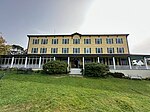
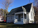
Chebeague Island is located in Casco Bay, an inlet of the Gulf of Maine. It was originally used as a fishing ground by Abenaki Native Americans. Also known as Great Chebeague (pronounced "sha-big") Island, today it is a town in Cumberland County, Maine, United States. It is located 10 miles (16 km) northeast of Portland, Maine. Chebeague Island is the largest island in Casco Bay that is not connected to the mainland by a bridge. The largest island is Sebascodegan, or "Great Island," which is part of the Town of Harpswell and connected to the mainland via a 100ft bridge. Chebeague Island is one of the twelve major islands of the Calendar Islands, a term that originated in 1700 with the report by the English military engineer Wolfgang William Römer, who claimed there were "as many islands as there are days in the year." As a corrective, the Maine State Historian Robert M. York stated there are "little more than two hundred islands" in Casco Bay.Chebeague Island was a part of the Town of Cumberland until July 1, 2007, when it seceded and became the Town of Chebeague Island. The Town of Chebeague Island includes seventeen islands and their adjacent waters. These include the islands of Bangs, Bates, Hope, Ministerial, Sand, Stave, Stockman, and the tiny Upper Green Islands. At the 2020 census, the town's year-round population was 396. The population is said to more than triple in the summer months. Chebeague Island is part of the Portland–South Portland–Biddeford, Maine Metropolitan Statistical Area.
Excerpt from the Wikipedia article Chebeague Island (License: CC BY-SA 3.0, Authors, Images).Chebeague Island
South Road,
Geographical coordinates (GPS) Address Nearby Places Show on map
Geographical coordinates (GPS)
| Latitude | Longitude |
|---|---|
| N 43.740833333333 ° | E -70.108055555556 ° |
Address
Doughty's Island Market
South Road 237
04017
Maine, United States
Open on Google Maps


