place

Castleshaw

Geography of the Metropolitan Borough of OldhamGreater Manchester geography stubsSaddleworthTowns and villages of the Peak DistrictUse British English from February 2015
Villages in Greater Manchester
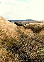
Castleshaw, Bleak Hey Nook Lane (geograph 3042225)

Castleshaw is a hamlet in the Saddleworth parish of the Metropolitan Borough of Oldham in Greater Manchester, England. It lies amid the Pennines, 2.4 miles (3.9 km) north of Uppermill, 3 miles (4.8 km) west-southwest of Marsden, and 5.3 miles (8.5 km) east-northeast of Oldham. Historically a part of the West Riding of Yorkshire, Castleshaw is most notable for the Castleshaw Roman fort, the remains of an ancient castrum. There are two reservoirs, Castleshaw upper reservoir and Castleshaw lower reservoir. In 2016, United Utilities reinforced the walls on the lower reservoir but had to drop water levels by 1m.

Excerpt from the Wikipedia article Castleshaw (License: CC BY-SA 3.0, Authors, Images).

Castleshaw
Bleak Hey Nook Lane,

Geographical coordinates (GPS) Address Nearby Places
placeShow on map

Wikipedia: CastleshawContinue reading on Wikipedia

Geographical coordinates (GPS)

Latitude Longitude
N 53.583 ° E -1.999 °
placeShow on map

Address

Bleak Hey Nook Lane

Bleak Hey Nook Lane
OL3 5LY , Saddleworth
England, United Kingdom
mapOpen on Google Maps

Castleshaw, Bleak Hey Nook Lane (geograph 3042225)
Share experience

Nearby Places

Saddleworth
Saddleworth

Saddleworth is a civil parish of the Metropolitan Borough of Oldham in Greater Manchester, England. It comprises several villages and hamlets as well as suburbs of Oldham on the west side of the Pennine hills. Areas include Austerlands, Delph, Denshaw, Diggle, Dobcross, Friezland, Grasscroft, Greenfield, Grotton, Lydgate, Scouthead, Springhead and Uppermill.Saddleworth lies east of Oldham and 11 miles (17.7 km) northeast of Manchester. It is broadly rural and had a population of 25,460 at the 2011 Census, making it one of the larger civil parishes in the United Kingdom. Historically in the West Riding of Yorkshire and following the Industrial Revolution, in the 18th and 19th centuries, Saddleworth became a centre for cotton spinning and weaving. By the end of Queen Victoria's reign, mechanised textile production had become a vital part of the local economy. The Royal George Mill, owned by the Whitehead family, manufactured felt used for pianofortes, billiard tables and flags. Following the Great Depression Saddleworth's textile sector declined. Much of Saddleworth's architecture and infrastructure dates from its textile processing days however, notably the Saddleworth Viaduct and several cottages and terraces, many built by the local mill owners. For centuries Saddleworth was linked, ecclesiastically, with the parish of Rochdale and was long talked of as the part of Yorkshire where Lancastrians lived. The former Saddleworth Urban District was the only part of the West Riding to have been amalgamated into Greater Manchester in 1974. However, strong cultural links with Yorkshire remain amongst its communities. There are several brass bands in the parish.

Standedge Tunnels
Standedge Tunnels

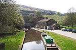
The Standedge Tunnels () are four parallel tunnels through the Pennine hills at the Standedge crossing between Marsden in Kirklees, West Yorkshire and Diggle in Oldham, Greater Manchester in northern England. Three are railway tunnels (containing the Huddersfield line) and the other is a canal tunnel. Before boundary changes in 1974, both ends of the tunnels were in the West Riding of Yorkshire. The canal tunnel on the Huddersfield Narrow Canal was authorised by an Act of Parliament on 4 April 1794. Construction of a 5,451-yard (4,984 m) tunnel began months later. Within two years, cost-saving measures pushed back its completion date and progress was slowed by water levels much greater than had been expected. It proved difficult to secure skilled help, some tenders went unanswered and Benjamin Outram withdrew from the venture. In 1807, Thomas Telford drew up a new plan for its completion. In 1811, the tunnel opened. It is the longest and oldest of the four Standedge tunnels and is the longest, highest, and deepest canal tunnel in the United Kingdom. Having been closed to all traffic in 1943, the canal tunnel was re-opened in May 2001. The first, single-track railway tunnel, built for the London and North Western Railway (LNWR) on its line between Huddersfield and Manchester, was completed in 1848. It proved to have insufficient capacity and a second, parallel, single-track tunnel was opened in 1871. The LNWR opened a third, double-track tunnel in 1894. Only the double-track tunnel is currently used for rail traffic; the other two are intact but disused. All four tunnels are linked by cross-tunnels or adits at strategic intervals which allowed the railway tunnels to be built without construction shafts and allowed waste material to be removed by boat. The Standedge Tunnel Visitor Centre, at the Marsden end, is a base for boat trips into the tunnel and has an exhibition depicting the different crossings.