Trinquetaille
ArlesBouches-du-Rhône geography stubsGeography of Bouches-du-RhôneMassalian colonies

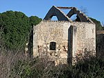
Trinquetaille is an area in the town of Arles, in southern France. It is located in the canton of Arles on the right bank of the "Grand Rhône". This position at the top of the Rhône delta makes it part of the Camargue. In the Middle Ages it was the site of an important fortification, the base of the House of Baux. Trinquetaille Castle was razed in 1161 during the Baussenque Wars, but later rebuilt.
Excerpt from the Wikipedia article Trinquetaille (License: CC BY-SA 3.0, Authors, Images).Trinquetaille
Place Saint-Pierre, Arles
Geographical coordinates (GPS) Address Nearby Places Show on map
Geographical coordinates (GPS)
| Latitude | Longitude |
|---|---|
| N 43.680555555556 ° | E 4.6222222222222 ° |
Address
Place Saint-Pierre
Place Saint-Pierre
13200 Arles
Provence-Alpes-Côte d'Azur, France
Open on Google Maps


