place

Sot's Hole Local Nature Reserve

Ancient woods in EnglandForests and woodlands of the West Midlands (county)Local Nature Reserves in the West Midlands (county)
Gate (3269748340)
Gate (3269748340)

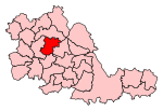
Sot's Hole is a local nature reserve in West Midlands, England. It is on the west side of Sandwell Valley, and north-east of West Bromwich.

Excerpt from the Wikipedia article Sot's Hole Local Nature Reserve (License: CC BY-SA 3.0, Authors, Images).

Sot's Hole Local Nature Reserve
Temple Meadows Road, Sandwell

Geographical coordinates (GPS) Address External links Nearby Places
placeShow on map

Wikipedia: Sot's Hole Local Nature ReserveContinue reading on Wikipedia

Geographical coordinates (GPS)

Latitude Longitude
N 52.529027777778 ° E -1.9836388888889 °
placeShow on map

Address

Sot's Hole Local Nature Reserve

Temple Meadows Road
B71 4DD Sandwell
England, United Kingdom
mapOpen on Google Maps

linkWikiData (Q97680645)
linkOpenStreetMap (134895673)

Gate (3269748340)
Gate (3269748340)
Share experience

Nearby Places

Sandwell Valley
Sandwell Valley

Sandwell Valley is an area of green belt in the county of West Midlands, England, on the border of Birmingham and West Bromwich, with Walsall at its northern end. It is a valley on the River Tame of which 720 hectares (1,800 acres) are owned by Sandwell Metropolitan Borough Council, with the RSPB leasing 25 acres as RSPB Sandwell Valley nature reserve. Within this large area, is the 270 hectares (670 acres) Sandwell Valley Country Park, which contains two visitor centres, Forge Mill Farm and Sandwell Park Farm, the former using modern farming techniques, the latter with a walled kitchen garden and rare breeds of farm animals, one of 16 farm parks approved nationally by the Rare Breeds Survival Trust. Sot's Hole is one of three Local Nature Reserves in the Country Park, and lies on the edge of the site on Dagger Lane/Church Vale, West Bromwich. In an effort to protect and restore the reserve, a group of local people joined together in November 2005 and formed the Friends of Sot's Hole. The earliest evidence of people in Sandwell Valley is in the form of flint tools from the Mesolithic period, but evidence of later periods is also present in the landscape, including the site of Sandwell Hall (home of the Earls of Dartmouth) and Sandwell Priory ruins (still evident today). Exhibitions at Sandwell Park Farm tell the story of the people who lived here. The M5 motorway bisects the Country Park, with the intersection between it and the M6 (considered Junction 8 of the M6) at the northern end, and junction 1 of the M5 to the south. The latter junction surrounds a surviving gatehouse from the hall. The Birmingham-Walsall Line, part of the former Grand Junction Railway, opened in 1837, runs through the northern end of the valley, with Hamstead railway station being the nearest. The former Newton Road railway station having closed some years ago. The highest point of Sandwell Valley is in Birmingham and is known as Hill Top, where the remains of a World War II gun emplacement can still be found there. The Country Park's fauna and flora are studied by the Sandwell Valley Naturalists' Club (SandNats). Every Saturday morning at 9.00am, the country park hosts a parkrun, a free, weekly timed 5 km run.Adjacent areas include Great Barr, Hamstead and Handsworth Wood.

The Public, West Bromwich

The Public was a multi-purpose venue and art gallery in West Bromwich, West Midlands, England, at the forefront of a regional regeneration programme which was – by late 2013– to also bring Europe's biggest Tesco, a multiplex cinema, restaurants and a new retail centre. It closed in November 2013. The building reopened as part of Sandwell College in October 2014. Despite indications that the arts centre would be at the forefront of West Bromwich's 'Golden Future', on 9 May 2013 it was announced that Sandwell Metropolitan Borough Council was in discussion with Sandwell College to potentially lease The Public for use as a sixth-form college. At that time, the College's own sixth-form was oversubscribed with six applicants for every place.In 2012–13 there were 380,000 visitors to the building from all sections of society – an increase of over 40% from the previous year. The Public's mission was to be a place where people came to create and make things for themselves and to enjoy other people's creativity – an echo of Cedric Price's concept of a Fun Palace. In 2012, The Guardian's Robert Clark described The Public as "a playground for adults" adding that "maybe that's a good role for a contemporary art gallery to embrace".It was also home to 27 small companies as well as the Sandwell Arts Trust, who managed the building. Between them they employed around 120 people with a further 120 digital media apprentices.An article in the previously critical Express and Star in September 2012 said that The Public was finally winning local people over, had found its purpose and belied remote odds to become one of the region's success stories. Just over a year later on 23 November 2013, The Public closed for good. The building was formally reopened as a sixth form college by Prince Edward, Earl of Wessex on 1 October 2014.

Stone Cross, West Midlands

Stone Cross is a residential area of West Bromwich in the metropolitan borough of Sandwell in the West Midlands of England. It is 2.5 miles (4.0 km) north of the town centre, and is situated around the A4034 road that links West Bromwich and Walsall. To the southwest is Charlemont and Grove Vale and to the north is Friar Park. Stone Cross takes its name from a wayside cross which stood until the 1890s - a replica was unveiled in 2002. It was a largely rural area until the late 1920s, when West Bromwich council built a large council housing development in the area, to the west of Walsall Road, which joined up with the new Friar Park estate, another council housing development. In the centre of Stone Cross, there is a roundabout surrounding the Stone Cross pub. Stone Cross also has a small shopping area including a library, which opened in 1975.On 10 November 1940, during World War II, a bomb landed on Walsall Road and damaged several houses, missing its target of a nearby anti-aircraft gun. There were no fatalities.The suburb is served by Tame Bridge railway station, which gives railway links to Birmingham, Walsall, Rugeley and Wolverhampton. The centre is a major interchange of the National Express West Midlands 40 and 4 bus services giving commuters alternative routes to West Bromwich, Walsall and Oldbury.Stone Cross is home to the countries largest St George's Day parade, which runs between Stone Cross and Dartmouth Park in West Bromwich. In 2014 it attracted around 15000 people.