place

Eastcotts

Borough of BedfordFormer civil parishes in BedfordshireUse British English from July 2016
Eastcotts
Eastcotts

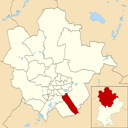
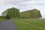
Eastcotts is an electoral ward within the Borough of Bedford, in the ceremonial county of Bedfordshire, England. It was formerly also a civil parish until its abolition on 1 April 2019, when Cotton End and Shortstown parishes were established.The boundaries of Eastcotts are approximately Exeter Wood to the east, Bedfordshire Greensand Ridge to the south and Shocott Spring to the west. There are two woodlands; Shocott Spring and Exeter Wood, two villages; Shortstown and Cotton End and two hamlets; Harrowden and Herrings Green. And some landmarks such as the Cardington Sheds.

Excerpt from the Wikipedia article Eastcotts (License: CC BY-SA 3.0, Authors, Images).

Geographical coordinates (GPS)

Latitude Longitude
N 52.097597 ° E -0.418091 °
placeShow on map

Address

Cotton End Lower School

High Road 37
MK45 3AA
England, United Kingdom
mapOpen on Google Maps

Eastcotts
Eastcotts
Share experience

Nearby Places

List of Sites of Special Scientific Interest in Bedfordshire

Bedfordshire is a county in the East of England. It is bounded by Hertfordshire to the south-east, Cambridgeshire to the north-east, Northamptonshire to the north, and Buckinghamshire to the west. It has an area of 1,235 square kilometres (477 sq mi), and population estimated in 2015 at 630,000, with an increase of 10% over the previous ten years. The county town is Bedford, and the name is first recorded in the treaty in about 879 between King Alfred the Great and Guthrum, which divided English and Danish territory by a line which went through Bedford.Southern Bedfordshire is part of the Chilterns Area of Outstanding Natural Beauty. North and mid Bedfordshire are undulating claylands with broad river valleys of the River Great Ouse and its tributaries, and the Bedfordshire Greensand Ridge. Jurassic and Cretaceous clays are overlaid by Quaternary glacial deposits of chalky boulder clay.There are forty Sites of Special Scientific Interest (SSSIs) in Bedfordshire, designated by Natural England. Thirty-five are listed for their biological interest, and five for their geological interest. Three of the sites are also national nature reserves, twelve are in the Chilterns Area of Outstanding Natural Beauty, and eleven are managed wholly or partly by the Wildlife Trust for Bedfordshire, Cambridgeshire and Northamptonshire. In 2009 Bedfordshire was divided into three unitary local authorities: thirty-two sites are in Central Bedfordshire, eight in Bedford and none in Luton.

List of local nature reserves in Bedfordshire

Bedfordshire is a county in the East of England. It is bounded by Hertfordshire to the south-east, Cambridgeshire to the north-east, Northamptonshire to the north, and Buckinghamshire to the west. It has an area of 1,235 square kilometres (477 sq mi), and a population estimated in 2016 at 640,000, with an increase of 11% over the previous ten years. Geographically, it is mainly rural, but still the fourteenth most densely populated county of England, with over half the population living in the two largest built-up areas, Luton and Bedford. The county is governed by three unitary authorities, Bedford, Central Bedfordshire and Luton. The county town is Bedford, and the name is first recorded in the treaty in about 879 between King Alfred the Great and Guthrum, which divided English and Danish territory by a line which went through Bedford.Much of Luton and southern Bedfordshire lies in the Chilterns Area of Outstanding Natural Beauty. North and mid Bedfordshire are undulating claylands with broad river valleys of the River Great Ouse and its tributaries, and the Bedfordshire Greensand Ridge. Jurassic and Cretaceous clays are overlaid by Quaternary glacial deposits of chalky boulder clay.Local nature reserves (LNRs) are designated by local authorities under the National Parks and Access to the Countryside Act 1949. The local authority must have a legal control over the site, by owning or leasing it, or having a legal agreement with the owner. LNRs are sites which have a special local interest either biologically or geologically, and local authorities have a duty to care for them. They can apply local bye-laws to manage and protect LNRs.As of March 2016 there are twenty local nature reserves in Bedfordshire: eight in Bedford, eleven in Central Bedfordshire and one in Luton. The largest is Harrold-Odell Country Park with 59.3 hectares (147 acres); it is a former quarry on the bank of the River Great Ouse which has river meadows and two lakes. The smallest is Hill Rise at 0.9 hectares (2.2 acres); it is close to Bedford town centre and surrounded on three sides by houses, but it has a variety of habitats. There is public access to all the sites.