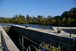
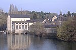
Ouette (river)
Commons category link is locally definedFrance river stubsMayenne geography stubsPages with French IPARivers of France ... and 3 more
Rivers of MayenneRivers of Pays de la LoireTributaries of the Mayenne

The Ouette (French pronunciation: [wɛt]) is a 35 km (22 mi) long river in western France located in the department of Mayenne, region of Pays de la Loire. It is a tributary of the river Mayenne on the left side, and so is a sub-tributary of the Loire by Mayenne and Maine.
Excerpt from the Wikipedia article Ouette (river) (License: CC BY-SA 3.0, Authors, Images).Ouette (river)
Chemin de Halage, Château-Gontier
Geographical coordinates (GPS) Address Nearby Places Show on map
Geographical coordinates (GPS)
| Latitude | Longitude |
|---|---|
| N 47.970277777778 ° | E -0.72 ° |
Address
Chemin de Halage
Chemin de Halage
53360 Château-Gontier
Pays de la Loire, France
Open on Google Maps


