place

South Wilford

Former civil parishes in NottinghamshireNottinghamshire geography stubs

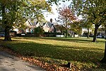
South Wilford was a civil parish in Nottinghamshire from 1894 to 1935. It was formed under the Local Government Act 1894 from the parts of the parishes of Wilford and Lenton which were not part of the county borough of Nottingham. It formed part of the Basford Rural District. In 1935, under a County Review Order, the parish became part of the West Bridgford urban district. The part of the parish west of the railway line was added to the city of Nottingham in 1952.

Excerpt from the Wikipedia article South Wilford (License: CC BY-SA 3.0, Authors).

South Wilford
Manor House Close, Nottingham Wilford

Geographical coordinates (GPS) Address Nearby Places
placeShow on map

Wikipedia: South WilfordContinue reading on Wikipedia

Geographical coordinates (GPS)

Latitude Longitude
N 52.933 ° E -1.159 °
placeShow on map

Address

Manor House Close 2
NG11 7BR Nottingham, Wilford
England, United Kingdom
mapOpen on Google Maps

Share experience

Nearby Places

Wilford Lane tram stop

Wilford Lane is a tram stop on the Nottingham Express Transit (NET) network, in the titular city, England. The stop takes its name from Wilford Lane and the village of Wilford, and lies on the boundary between the city of Nottingham and the district of Rushcliffe. The stop is on line 2 of the NET, from Phoenix Park via the city centre to Clifton, and trams run at frequencies that vary between 4 and 8 trams per hour, depending on the day and time of day.The tram line and stop is located on the course of the former Great Central main line, which once linked London with Nottingham and Sheffield, but which closed in 1969. The railway line here ran on an embankment and crossed Wilford Lane on a low bridge, but the bridge was removed after closure to permit the operation of double deck buses. The remaining embankment at the stop location was removed as part of the preparation for the new line, and the tramway now crosses Wilford Lane on the level. To the north of the stop, the Great Central embankment is retained but unused, and the tram line runs at ground level to its east side. To the south of the stop, the tram line rises up to run along the top of the retained embankment.The stop is on reserved track and comprises a pair of side platforms flanking the tracks. To the east of the stop is a secure works compound which is served by a tram siding that diverges from the main line to the south of the level crossing and crosses Wilford Lane separately.Wilford Lane opened on 25 August 2015, along with the rest of NET's phase two.

Clifton Bridge (Nottingham)

Clifton Bridge is a road bridge spanning the River Trent and carrying the A52 road to the west of the city of Nottingham, in the county of Nottinghamshire, England. It was completed and opened to traffic in March 1958 and is constructed of pre-stressed concrete. It is the next upstream road crossing from the older famous Trent Bridge. Clifton Bridge was initially built to relieve traffic pressures on Trent Bridge. The current west bridge over the Trent at Clifton Bridge includes a section of the former B680 (which followed the route into Nottingham now used by the A453). The 275 ft bridge was formally opened on 5 June 1958 by Princess Alexandra, The Honourable Lady Ogilvy. At the time it was the longest pre-stressed concrete bridge in the country.With the addition of the east bridge the crossing became dual-carriageway as the A614 as part of a 1+1⁄4-mile (2.0 km) £3.2 million section (equivalent to £43,163,449 in 2020),, opening in 1972. The eight lane bridge is a part of major regional route linking Derby and Grantham as well as serving local traffic in Nottingham.The bridge is also open to segregated pedestrian and cycle traffic. In 1994 a survey revealed corrosion damage to up to 25% of the pre-stressing wires. The bridge was strengthened by post-stressing with additional external cables.In February 2020 during routine maintenance work, it was discovered that water damage had corroded steelwork under the bridge. This caused a temporary closure of the east bridge, which carries all eastbound traffic and one lane of westbound traffic, while the bridge was repaired. By the end of 2021, the bridge had fully reopened to all road traffic, due to the repairs being completed.