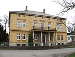
Central Elbe Table
Geography of the Central Bohemian RegionLandforms of the Czech RepublicPlateaus of Europe

The Central Elbe Table (Czech: Středolabská tabule) is a plateau and a geomorphological mesoregion of the Czech Republic. It is located mostly in the Central Bohemian Region, but due to its size, it also extends to other regions. The axis of the plateau is the Elbe river, after which the territory is named.
Excerpt from the Wikipedia article Central Elbe Table (License: CC BY-SA 3.0, Authors, Images).Central Elbe Table
Poděbradská, okres Nymburk
Geographical coordinates (GPS) Address Nearby Places Show on map
Geographical coordinates (GPS)
| Latitude | Longitude |
|---|---|
| N 50.133333333333 ° | E 14.983333333333 ° |
Address
Poděbradská 1083
289 12 okres Nymburk, Sadská
Central Bohemia, Czechia
Open on Google Maps


