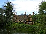
Marston Vale

Marston Vale is an area of Bedfordshire. It lies to the south west of Bedford and Kempston, near Junction 13 of the M1 motorway. Historically it was one of the main brickmaking districts in England, home of the London Brick Company, now a division of Hanson plc. The brickmaking activity left scars across the landscape of the Marston Vale as large tracts of land were dug for clay. Most of the claypits are now exhausted, and most of the brickmaking chimneys have been demolished. The legacy of the abandoned brickworks also adds to the impression that the Marston Vale has been despoiled by decades of industrial activity and it is now searching for a new identity. In more recent years the local authorities have taken the opportunity to reuse the clay pits for landfills at Stewartby and Brogborough, both of which are recently capped and closed down.
Excerpt from the Wikipedia article Marston Vale (License: CC BY-SA 3.0, Authors, Images).Marston Vale
Wetlands,
Geographical coordinates (GPS) Address Nearby Places Show on map
Geographical coordinates (GPS)
| Latitude | Longitude |
|---|---|
| N 52.062 ° | E -0.538 ° |
Address
Wetlands
Wetlands
MK43 0PR , Marston Moretaine
England, United Kingdom
Open on Google Maps


