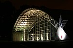
Brighton Hill
Areas of Basingstoke
Brighton Hill is a district of Basingstoke, England, that was formed around 1970 as part of the Town Centre Development Plan. The area is bounded to the west by the newer housing estate of Hatch Warren and by the A30. To the east of Brighton Hill, the Viables Industrial Estate and Cranbourne area. The area to the east is a lot older than Brighton Hill itself. The M3 motorway runs in a straight line to the south of the area, directly next to the southern ebb of Brighton Hill, which sometimes is referred to as Old Hatchwarren.
Excerpt from the Wikipedia article Brighton Hill (License: CC BY-SA 3.0, Authors).Brighton Hill
Brighton Hill Roundabout, Basingstoke and Deane South Ham
Geographical coordinates (GPS) Address Nearby Places Show on map
Geographical coordinates (GPS)
| Latitude | Longitude |
|---|---|
| N 51.250058 ° | E -1.111198 ° |
Address
Brighton Hill Roundabout
Brighton Hill Roundabout
RG22 4BE Basingstoke and Deane, South Ham
England, United Kingdom
Open on Google Maps


