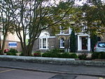
Ham Urban District

Ham was a local government district in north east Surrey, England around the village of Ham from 1894 to 1933. Ham Common Local Government District was formed under the Local Government Act 1858 and was governed by a local board of eight members. The Local Government Act 1894 reconstituted the area as Ham Urban District, with an elected urban district council of 10 members replacing the local board. The urban district consisted of the civil parish of Ham with Hatch, renamed as "Ham" in 1897.The urban district was abolished in 1933, when a county review order included its area in an enlarged Municipal Borough of Richmond. Since 1965 Ham has been part of the London Borough of Richmond upon Thames.
Excerpt from the Wikipedia article Ham Urban District (License: CC BY-SA 3.0, Authors, Images).Ham Urban District
Barnfield Gardens, London
Geographical coordinates (GPS) Address Nearby Places Show on map
Geographical coordinates (GPS)
| Latitude | Longitude |
|---|---|
| N 51.43 ° | E -0.3 ° |
Address
Barnfield Gardens
Barnfield Gardens
KT2 5RJ London (Royal Borough of Kingston upon Thames)
England, United Kingdom
Open on Google Maps


