place

Lower Intervale Grange No. 321

Buildings and structures completed in 1912Buildings and structures in Grafton County, New HampshireGrange buildings on the National Register of Historic PlacesGrange organizations and buildings in New HampshireNational Register of Historic Places in Grafton County, New Hampshire
New Hampshire Registered Historic Place stubsPlymouth, New HampshireUse mdy dates from August 2023
Lower Intervale Grange No. 321 2

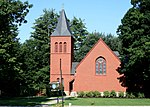
The Lower Intervale Grange #321, at 471 Daniel Webster Highway in the town of Plymouth in Grafton County, New Hampshire, was listed on the National Register of Historic Places in 2022.The Grange Hall was built in 1912, and the building has changed little since.It was listed "for its architectural integrity as well as for its association with the national Grange movement."It is a one-and-a-half-story building, clapboarded, with a "distinctive shed roof" and a front-facing gable. Its front porch, rebuilt in 2021, includes original or restored balusters, "corner posts with ornamental turnings and scrolled sawn brackets." Two cornerstones show "1912" and "L.I.G." Apparently ten cents was the price to have your name recorded in paper within one of the cornerstones. Its lower level is accessible from the side and includes kitchen facilities.The Manchester Ink Link online newspaper has published photos of the main meeting space and of the exterior.

Excerpt from the Wikipedia article Lower Intervale Grange No. 321 (License: CC BY-SA 3.0, Authors, Images).

Lower Intervale Grange No. 321
Daniel Webster Highway,

Geographical coordinates (GPS) Address Nearby Places
placeShow on map

Wikipedia: Lower Intervale Grange No. 321Continue reading on Wikipedia

Geographical coordinates (GPS)

Latitude Longitude
N 43.7237 ° E -71.6761 °
placeShow on map

Address

Daniel Webster Highway 425
03264
New Hampshire, United States
mapOpen on Google Maps

Lower Intervale Grange No. 321 2
Share experience

Nearby Places

Plymouth Historic District (Plymouth, New Hampshire)

The Plymouth Historic District encompasses a cluster of five civic buildings (of which four contribute to the district's significance) and the town common of Plymouth, New Hampshire, United States. The buildings are arrayed on the west side of Plymouth's town common, laid out not long after the town's settlement in 1763. The 2-acre (0.81 ha) district includes the town hall/court house, the Pemigewasset National Bank building, and the US Post Office building, as well as the Old Grafton County Courthouse (now a local history museum). The Plymouth Congregation Church also falls within the district bounds, but is not considered contributing. The district was listed on the National Register of Historic Places in 1986. Plymouth was granted township status in 1763, with significant settlement not taking place until the 1770s. The town center is located on terraces on the west bank of the Pemigewasset River, with its commercial core extending along Main Street (United States Route 3). The town common is an oval bounded on the east by Main Street, where commercial buildings face it, and the west by Post Office Square, where the buildings of the historic district are arrayed. Its most prominent feature is a fountain, depicting a Boy Scout kneeling with cupped hands to hold water; it was designed by George Borst, a summertime resident of Plymouth, and placed in 1933. It was here that the town's first colonial meeting house was built, on whose site the 20th-century Congregational Church now stands. Just to its north stands Plymouth Town Hall, built in 1890 to a design by New Hampshire architect C. Willis Damon to also serve as a county courthouse. Adjacent to the town hall is the Old Grafton County Courthouse, one of the state's oldest civic buildings, built in 1774. South of the church stands the 1885 Pemigewasset National Bank building, still in use as a bank, and the 1936 post office.