place

Wayland, Norfolk

Breckland DistrictGeography of NorfolkNorfolk geography stubs

Wayland is an area in the district of Breckland within the English county of Norfolk. It is situated approximately 20 miles west of Norwich. The area is a historic Hundred, and was originally called Wanelunt, or Waneland. It centres on the town of Watton, and encompasses the villages of Ashill, Carbrooke, Caston, Great Cressingham, Great Hockham, Griston, Little Cressingham with Threxton, Merton, Ovington, Saham Toney, Scoulton, Stow Bedon with Breckles, and Thompson. The area is crossed by Peddars Way, a 46-mile footpath that follows the route of a Roman road, and is the location of Wayland Wood, famed as the setting for the Babes in the Wood legend. Wayland has a local newspaper and many local businesses. The Chamber of Commerce also maintains an information directory of local organisations contact details.

Excerpt from the Wikipedia article Wayland, Norfolk (License: CC BY-SA 3.0, Authors).

Wayland, Norfolk
Stow Road, Breckland District Caston

Geographical coordinates (GPS) Address Nearby Places
placeShow on map

Wikipedia: Wayland, NorfolkContinue reading on Wikipedia

Geographical coordinates (GPS)

Latitude Longitude
N 52.53 ° E 0.89 °
placeShow on map

Address

Stow Road

Stow Road
NR17 1DB Breckland District, Caston
England, United Kingdom
mapOpen on Google Maps

Share experience

Nearby Places

Stow Bedon
Stow Bedon

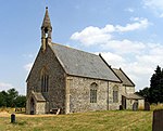
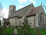
Stow Bedon is a village and former civil parish, now in the parish of Stow Bedon and Breckles, in the Breckland district of the English county of Norfolk. Stow Bedon adjoins the hamlet of Lower Stow Bedon, although the two are often considered to be one village. In the south of the parish is the village of Breckles. In 2011 the merged parish had a population of 290. The village’s name means 'Place'. The village was held by John di Bidun in the 13th century. The Domesday Book of 1086 mentions both Stow Bedon (together with Caston) and Breckles. The Inclosure Act mentions Stow Bedon as a 'Free Village' and mentions how the village "maintained an independent spirit". Further records show that during Queen Victoria's Jubilee, instead of the traditional roasting of an ox, Stow Bedon only roasted a pig. Kelly's Directory for 1883 records that Stow Bedon had a population of 324 with a total of 35 dwellings. It has been assumed in recent times, however, that the true number of houses during this period would have been greater. The village church dates from the 14th century and is dedicated to St Botolph; it is a Grade II* listed building. The south and west of the area is a separate ecclesiastical parish, and its church, St Margaret's at Breckles, is Grade I listed. A station at Stow Bedon, on the Thetford & Watton Railway, opened in October 1869 and closed with the line in June 1964. The Great Eastern Pingo Trail, a 13-kilometre circular walk, starts and finishes in the village. Parking is on the A1075, in the former railway station yard. The village fete is held annually in June, and St Botolph's church holds a flower festival. Stow Bedon is closely connected to the towns of Watton, Attleborough and Thetford.