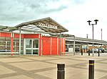
Port of Goole

The Port of Goole (also known as Goole Docks and The Port in Green Fields), is a maritime port at the mouth of the Aire and Calder Navigation where it feeds into the River Ouse, in the East Riding of Yorkshire, England. The port opened in 1826, when the Aire and Calder Navigation was completed, connecting to the River Ouse at what is now the town of Goole. The port is one of the Humber Ports, associated with the waterway of the Humber Estuary and its tributaries, and is known to be Britain's largest inland port, being some 50 miles (80 km) from the open sea. It has good road and rail transport links, and deals with about £800 million worth of trade each year. Originally the port was in the West Riding of Yorkshire, but was transferred to Humberside in 1974, then it was moved into the East Riding of Yorkshire in 1996.
Excerpt from the Wikipedia article Port of Goole (License: CC BY-SA 3.0, Authors, Images).Port of Goole
Bridge Street,
Geographical coordinates (GPS) Address Nearby Places Show on map
Geographical coordinates (GPS)
| Latitude | Longitude |
|---|---|
| N 53.698 ° | E -0.874 ° |
Address
Bridge Street
Bridge Street
DN14 5YP
England, United Kingdom
Open on Google Maps


