Raby, Merseyside
Former civil parishes in MerseysideTowns and villages in the Metropolitan Borough of Wirral

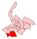
Raby (locally ) is a hamlet and former civil parish, in the Wirral district, in the county of Merseyside, England, on the Wirral Peninsula. It is located within the Clatterbridge Ward. The settlement is within the parliamentary constituency of Wirral South. Raby is situated approximately 4 km (2.5 mi) to the north east of the town of Neston and 5 km (3.1 mi) south west of Bebington, and close to Merseyside's boundary with Cheshire. The hamlet of Raby Mere is located 3.6 km (2.2 mi) to the east. At the time of the United Kingdom Census 2001, Raby had a total population of 100.
Excerpt from the Wikipedia article Raby, Merseyside (License: CC BY-SA 3.0, Authors, Images).Raby, Merseyside
Raby Road, Wirral
Geographical coordinates (GPS) Address Nearby Places Show on map
Geographical coordinates (GPS)
| Latitude | Longitude |
|---|---|
| N 53.312 ° | E -3.038 ° |
Address
Raby Road
Raby Road
CH63 1JP Wirral
England, United Kingdom
Open on Google Maps


