Fat Tau Chau
Hang HauNew Territories geography stubsVillages in Sai Kung District, Hong Kong
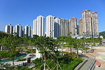
Fat Tau Chau Village (Chinese: 佛頭洲村) aka. Fu Tau Chau (斧頭洲) is a village in the Hang Hau area of Sai Kung District, New Territories, Hong Kong.
Excerpt from the Wikipedia article Fat Tau Chau (License: CC BY-SA 3.0, Authors).Fat Tau Chau
Sai Kung District
Geographical coordinates (GPS) Address Nearby Places Show on map
 Continue reading on Wikipedia
 Geographical coordinates (GPS)
| Latitude | Longitude |
|---|---|
| N 22.31395 ° | E 114.268706 ° |
Address
62
Sai Kung District
Hong Kong, China
Open on Google Maps