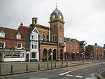
Freeman's Marsh

Freeman's Marsh is a 25.1-hectare (62-acre) biological Site of Special Scientific Interest on the northern outskirts of Hungerford in Berkshire. It is in the North Wessex Downs, which is an Area of Outstanding Natural Beauty. The site is owned by the Town and Manor of Hungerford.Freeman's Marsh is in the flood plain of the River Dun, which goes through the site. It has unimproved meadows, which have long been traditionally managed by grazing, marsh, reedbeds and scattered woodland. Many species of birds nest on the river bank and in the marshy meadows, including snipe, little grebes and mute swans, while sedge warblers, reed warblers and reed buntings nest in tall fen and reed.The site is crossed by public footpaths.
Excerpt from the Wikipedia article Freeman's Marsh (License: CC BY-SA 3.0, Authors, Images).Freeman's Marsh
Hungerford Freeman Marsh,
Geographical coordinates (GPS) Address Nearby Places Show on map
Geographical coordinates (GPS)
| Latitude | Longitude |
|---|---|
| N 51.415 ° | E -1.532 ° |
Address
Hungerford Freeman Marsh
Hungerford Freeman Marsh
RG17 0QN
England, United Kingdom
Open on Google Maps


