place

Singapore Island

Islands of SingaporeIslands of the South China SeaPages with non-numeric formatnum arguments
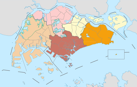
Singapore Planning Regions

Singapore Island, or Mainland Singapore, is the main constituent island of the sovereign island country and city-state of the Republic of Singapore. It is located at the southern tip of Malay Peninsula, in-between the Straits of Malacca and the South China Sea. The Singapore Strait lies to the south, while the Johor Strait lies to the north. The island forms the bulk of the country in terms of area, population and prominence, since areas situated on the country's smaller islands consists of military or industrial areas, with the exceptions being Sentosa as well as Ubin Island. As of June 2021, Singapore's population stood at 5.45 million and the mainland has a land area of approximately 710 square kilometres (270 sq mi).

Excerpt from the Wikipedia article Singapore Island (License: CC BY-SA 3.0, Authors, Images).

Geographical coordinates (GPS)

Latitude Longitude
N 1.3666666666667 ° E 103.8 °
placeShow on map

Address

Central Water Catchment


, Central Water Catchment
Singapore
mapOpen on Google Maps

Singapore Planning Regions
Share experience

Nearby Places

Central Catchment Nature Reserve

The Central Catchment Nature Reserve (Chinese: 中央集水区自然保护区; Malay: Hutan Simpanan Kawasan Tadahan Air Tengah; Tamil: மத்திய நீர்ப்பிடிப்பு இயற்கை ரிசர்வ்) is the largest nature reserve in Singapore, occupying 2880 hectares. Forming a large green lung in the geographical centre of the city, it houses several recreational sites, including the Singapore Zoo, the Night Safari and the River Safari, as well as several newer facilities built to encourage public appreciation of the reserve, such as the HSBC TreeTop Walk. The reserve sits within the boundaries of the Central Water Catchment. It is one of the four gazetted nature reserves in Singapore. The other three are the Labrador Nature Reserve which was gazetted since 1 January 2002, Sungei Buloh Wetland Reserve and Bukit Timah Nature Reserve. All four nature reserves along with the parks are protected under the Parks & Trees Act 2005. The nature reserve acts as a catchment area for the surrounding reservoirs. The country's main reservoirs – MacRitchie, Upper Seletar, Upper Peirce and Lower Peirce are located within the reserve.Most forests in the CCNR were cleared for logging and cultivation unlike Bukit Timah Nature Reserve, which remain relatively undisturbed. The CCNR now consists of a mixture of young and mature secondary forests with virgin primary forest surrounding the reservoirs.