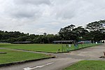
Bukit Timah Satellite Earth Station
1986 establishments in SingaporeEarth stations in SingaporeSingapore geography stubs

The Bukit Timah Satellite Earth Station (Chinese: 武吉知马卫星地面站; Malay: Stesen Satelit Bumi Bukit Timah) is the second satellite earth station in Singapore after Sentosa Satellite Earth Station in Sentosa Island. The station is located in Bukit Timah near Chantek flyover between Bukit Timah Expressway (BKE) and Pan Island Expressway (PIE). This station is managed and owned by Singtel with the building starting construction in 1983 and started operations in 1986. As it is located next to the BKE, motorists coming into Singapore via the causeway see this as their first landmark other than Woodlands.
Excerpt from the Wikipedia article Bukit Timah Satellite Earth Station (License: CC BY-SA 3.0, Authors, Images).Bukit Timah Satellite Earth Station
Bukit Timah Expressway,
Geographical coordinates (GPS) Address External links Nearby Places Show on map
Geographical coordinates (GPS)
| Latitude | Longitude |
|---|---|
| N 1.352 ° | E 103.791 ° |
Address
Bukit Timah Satellite Earth Station
Bukit Timah Expressway
289759 , Central Water Catchment
Singapore
Open on Google Maps


