place

Ruthven railway station

Railway stations in Australia opened in 1963Railway stations in MelbourneRailway stations in the City of DarebinUse Australian English from February 2015
Ruthven Railway Station

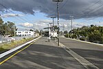
Ruthven railway station is located on the Mernda line in Victoria, Australia. It serves the northern Melbourne suburb of Reservoir, and it opened on 5 August 1963.

Excerpt from the Wikipedia article Ruthven railway station (License: CC BY-SA 3.0, Authors, Images).

Ruthven railway station
High Street, Melbourne Reservoir

Geographical coordinates (GPS) Address Nearby Places
placeShow on map

Wikipedia: Ruthven railway stationContinue reading on Wikipedia

Geographical coordinates (GPS)

Latitude Longitude
N -37.7079 ° E 145.0094 °
placeShow on map

Address

Ruthven

High Street
3073 Melbourne, Reservoir
Victoria, Australia
mapOpen on Google Maps

Ruthven Railway Station
Share experience

Nearby Places

Edwardes Lake
Edwardes Lake

Edwardes Lake is a recreational waterbody in the Melbourne, Australia, suburb of Reservoir, formed by the damming of Edgars Creek at Edwardes Street. it is surrounded by Edwardes Lake Park. Edwardes Lake was formed in 1888 as a private enterprise by construction of an embankment across the creek. The facility included boat sheds and refreshment rooms while sporting events were held on the lake. A tramway was proposed to connect Heidelberg and Coburg running past the lake, but the collapse of the land boom ended the project. the embankment was later partly washed away in floods.In 1914 Thomas Dyer Edwardes donated 34 acres of land to the City of Preston for the creation of a park. The Preston council purchased another 12 acres to add to the park. Carlo Catani, the Chief Engineer of the Public Works Department was approached to provide a plan for laying out the park. The Reservoir Progress Association fenced the parkland and planted over 700 trees. The official opening was on Saturday July 29 1916, presided over J. G. Membrey, M.L.A. the Mayor Cr C. Stanlake, Mr Henty on behalf of Mr Edwardes and J.S. McFadzean representing the Reservoir Progress Association. Mrs Membrey, Mrs Stanlake, Mrs McFadzean and Mrs Rae each planted a tree on the day.A memorial avenue was proposed to be planted, but may never have been carried out, however, a new concrete weir and spillway was funded in 1919 by a Repatriation grant, presumably with returned servicemen providing the labour, and an Armistice Memorial stone was inset into the weir. The new work was officially opened on 3 April 1920 by Brigadier-General Brand. The improvements allowed swimming to be officially permitted, the Preston Rowing Club to be formed and the Preston Lifesaving Club to demonstrate swimming and lifesaving techniques between 1919 and 1939.

Reservoir High School (Victoria)

Reservoir High School is a medium-sized co-educational, year 7 to 12 public high school, with approximately 700 students in Reservoir, Victoria, Australia. The school has a well established International Student Program. The program includes students from a range of countries such as China, Vietnam, Nepal, Thailand, India and Saudi Arabia. Reservoir High School is one of a select group of secondary colleges to be accredited to offer advanced learning classes (SEAL or Select Entry Accelerated Learning). In 2021, Reservoir High was recognised by the Age newspaper as a 'School that Excels' due to the continued improvement of its students' achievements and excellent results in the Victorian Certificate of Education. The school's improving achievement is based on a culture of respect and firm discipline, underpinned by strengths based restorative practices and strong focus on the straightforward 'Gradual Release Model' of teaching. Reservoir High has undergone a renewal of its teaching spaces and grounds. This includes the construction of a 250 seat Performing Arts Centre, a new Senior School building, 5 external competition grade netball courts (as well as the 4 internal courts as part of the joint use agreement on the Darebin Sports Stadium) and added in 2022 a new Visual Arts and Technology building. The facilities support all students to achieve at their best in a wide range of pathway programs which are designed to promote the passions, talents and interests of a diverse variety of students.

Division of Batman
Division of Batman

The Division of Batman was an Australian Electoral Division in the state of Victoria. It took its name from John Batman, one of the founders of the city of Melbourne. The division was created in 1906, replacing the Division of Northern Melbourne, and was abolished in 2019 and replaced by the Division of Cooper.The division was located in Melbourne's northern suburbs. It covered an area of approximately 66 square kilometres (25 sq mi) from Thomastown/Bundoora in the north to Clifton Hill in the south, with Merri Creek providing the vast majority of the western boundary and Darebin Creek, parts of Macleod and Plenty Road in Bundoora providing the eastern boundary. The suburbs of Alphington, Clifton Hill, Fairfield, Kingsbury, Northcote, Preston, Reservoir, and Thornbury; and parts of Bundoora, Coburg North, Macleod, and Thomastown were in this division.Held by Labor for all but 10 years of its history, Batman has traditionally been a safe Labor seat. However, the Greens have made the seat a contest since 2010, where they reduced Labor from a 26.0% margin to a 7.9% margin. Though Labor increased their margin against the Greens to 10.6% in 2013, the Greens reduced Labor's margin to just 1.0% in 2016. At the 2018 Batman by-election however, Labor increased their margin to 4.4% against the Greens.In June 2018, the Australian Electoral Commission announced that, at the 2019 Australian federal election, the division would be re-named Cooper, after Aboriginal community leader and activist William Cooper.