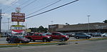
West End (also referred to as West Lakeview) is a neighborhood of the city of New Orleans. A subdistrict of the Lakeview District Area, its boundaries as defined by the City Planning Commission are: Lake Pontchartrain to the north, the New Basin Canal and Pontchartrain Boulevard to the east, Veterans Boulevard to the south, and the 17th Street Canal to the west. The area was largely built on land reclaimed from Lake Pontchartrain. It is a commercial seafood and recreational boating hub for the city and has been known for its seafood restaurants. In recent years, the area has seen large condominium-complex developments built which overlook the Lake, marinas, and centrally located 30-acre (120,000 m2) West End Park.
The majority of the land and marinas at West End are managed by the New Orleans Municipal Yacht Harbor Management Corporation, a public-benefit corporation of the City of New Orleans, with much of it leased to private interests and individuals.
The area is immediately north of the site of the levee failure on the 17th Street Canal during Hurricane Katrina, which was a primary cause of the inundation and devastation of many neighborhoods in New Orleans. Located outside of the flood walls, West End experienced some severe damage, but it was limited to heavy winds and high water destroying the restaurants and music clubs built on piers over the lake. Because West End was developed above sea level, the neighborhood only flooded due to the storm surge coming in from Lake Pontchartrain. After the water rapidly receded, the location became a staging area for the US Coast Guard, the Louisiana National Guard, and the Massachusetts National Guard, who were conducting rescues of stranded residents.Two yacht club facilities, the New Orleans Yacht Club and Southern Yacht Club, along with a number of marine-related businesses, condominiums, and boathouses, occupy the area surrounding the park, marinas, and boat channels. West End's most recognizable icon, the New Canal Lighthouse or more commonly New Basin Canal Lighthouse, originally constructed in 1838, was heavily damaged by Hurricanes Katrina and Rita. Reconstruction of the familiar landmark began in February 2012 and was completed in 2013.
 Continue reading on Wikipedia