Ammerstol
Former municipalities of South HollandKrimpenerwaardPopulated places in South HollandSouth Holland geography stubs

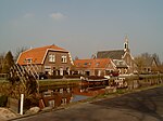
Ammerstol is a village, part of the municipality of Krimpenerwaard in the Netherlands. It is located about 12 kilometres (7.5 mi) southeast of Gouda, on the Lek River. Between 1817 and 1985, Ammerstol was an independent municipality. Until 2015, it was part of Bergambacht. Ammerstol has two listed Rijksmonuments: the 17th century inventory of its Reformed Church (itself built during 1880-81), and a thatched-roof farmhouse.
Excerpt from the Wikipedia article Ammerstol (License: CC BY-SA 3.0, Authors, Images).Ammerstol
Willem van Lutterveldstraat, Krimpenerwaard
Geographical coordinates (GPS) Address Nearby Places Show on map
Geographical coordinates (GPS)
| Latitude | Longitude |
|---|---|
| N 51.9275 ° | E 4.8086111111111 ° |
Address
Willem van Lutterveldstraat
2865 XT Krimpenerwaard
South Holland, Netherlands
Open on Google Maps


