place

Spitlers Edge

Geography of ChorleyHills of the West Pennine MoorsMountains and hills of Lancashire

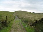
Spitlers Edge is a ridge running along the eastern edge of Anglezarke Moor, Chorley, Lancashire, England from Standing Stones Hill to Hordern Stoops. The peak, complete with a cairn at 1,286 feet (392 m), is the high point of the moorland. Redmonds Edge links Spitlers Edge to Great Hill and is paved. As of 2017, there are plans to extend the paving along the length of Spitlers Edge - with funding secured from the Lancashire Environmental Fund and United Utilities.Along the length of the edge is a stone wall of some historical importance - the boundary was built in 1841 as a relief measure to provide respite from the Hungry Forties, and is the parliamentary division boundary between Chorley and Blackburn. The name is derived from the fact that in mediaeval times, the Knights Hospitallers of St. John of Jerusalem used this route when travelling to their holdings in this district. The ridge provides the peaks that supply the source water to the River Yarrow.

Excerpt from the Wikipedia article Spitlers Edge (License: CC BY-SA 3.0, Authors).

Geographical coordinates (GPS)

Latitude Longitude
N 53.652 ° E -2.5252 °
placeShow on map

Address

Anglezarke


, Anglezarke
England, United Kingdom
mapOpen on Google Maps

Share experience

Nearby Places

Winter Hill (North West England)

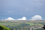
Winter Hill is a hill on which the three boroughs of Chorley, Blackburn with Darwen and Bolton meet, in the historic county of Lancashire in North West England. It is located on Rivington Moor, Chorley and is 1,496 feet (456 m) high. Part of the West Pennine Moors, it is a popular walking area, and has been the site of mining activity, aeroplane disasters and murders. Its prominent position made it the ideal site for the Winter Hill TV Mast, transmitting to a large part of North West England. There is also a number of other telecommunication masts and towers around the summit and side of the hill for mobile phones, Professional Mobile Radio users and emergency services. Lancashire Constabulary was the first to use the site for one of their base stations in 1950; they had to build the road and it is said to have been built by policemen.Paths to the summit lead from Belmont (in Blackburn with Darwen), Rivington (in Chorley borough), and Horwich and Blackrod (in Bolton borough). The summit can also be reached via a short walk from the top of a road pass 1+1⁄4 miles (2 km) west of Belmont. The hill is a prominent feature on the skyline for most of the borough of Chorley and further afield. Winter Hill's topographic prominence results in it being classified as a Marilyn. The trig point on its summit marks the highest point in Blackburn with Darwen whereas the highest point in the Metropolitan Borough of Bolton is 440 yards (400 m) away on its south east slope at 1,467 feet (447 m) above sea level. It offers views over Lancashire, Cheshire, Merseyside and the Greater Manchester Urban Area, including Manchester city centre, Salford, Werneth Low, Wigan and Bolton. In clear weather conditions, it also offers views of Blackpool Tower, the Dream in Sutton, St Helens, Jodrell Bank Observatory, Snaefell in the Isle of Man, the Cumbrian mountains, Snowdonia in North Wales, Liverpool, Southport, the Irish Sea, the Pennines and much of the North West of England. On a clear day the summit offers a view of four national parks: the Lake District, Yorkshire Dales, Peak District and Snowdonia.