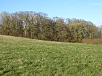
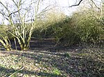
Dreweatt's Lock
Berkshire building and structure stubsGrade II listed buildings in BerkshireHamstead MarshallLocks of BerkshireLocks on the Kennet and Avon Canal ... and 2 more
United Kingdom canal stubsUse British English from February 2018

Dreweatt's Lock is a lock on the Kennet and Avon Canal, between Kintbury and Newbury, Berkshire, England. The lock has a rise/fall of 5 ft 9 in (1.75 m).It is a grade II listed building.
Excerpt from the Wikipedia article Dreweatt's Lock (License: CC BY-SA 3.0, Authors, Images).Dreweatt's Lock
Milkhouse Road,
Geographical coordinates (GPS) Address Nearby Places Show on map
Geographical coordinates (GPS)
| Latitude | Longitude |
|---|---|
| N 51.40325 ° | E -1.41054 ° |
Address
Milkhouse Road
RG20 0JG , Hampstead Marshall
England, United Kingdom
Open on Google Maps


