Deer Park, Toronto

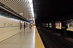
Deer Park is an affluent neighbourhood in Toronto, Ontario, Canada, centred on the intersection of Yonge Street and St. Clair Avenue. Its boundaries are the Vale of Avoca section of Rosedale ravine in the east, Farnham Avenue and Jackes Avenue in the south, Avenue Road and Oriole Parkway in the west, the Beltline Trail in the north on the west side of Yonge Street, and Glen Elm Avenue in the north on the east side of Yonge Street. For the purposes of social policy analysis and research, the Toronto government’s Social Development & Administration division includes Deer Park within the City of Toronto's official "Rosedale-Moore Park" and "Yonge-St.Clair" neighbourhood profiles. The neighbourhood is in Ward 22, represented by Councillor Josh Matlow at Toronto City Council. The commercial area along the main streets is known simply as Yonge and St. Clair. Marked by a cluster of office buildings, the area also includes a number of restaurants, shops, and services, as well as the St. Clair subway station, the terminus for the 512 St. Clair streetcar.
Excerpt from the Wikipedia article Deer Park, Toronto (License: CC BY-SA 3.0, Authors, Images).Deer Park, Toronto
Yonge Street, Toronto
Geographical coordinates (GPS) Address Nearby Places Show on map
Geographical coordinates (GPS)
| Latitude | Longitude |
|---|---|
| N 43.688055555556 ° | E -79.394027777778 ° |
Address
Yonge Street 1429
M4T 1Y7 Toronto
Ontario, Canada
Open on Google Maps


