Sierra de Guadalupe, Mexico
Coacalco de BerriozábalCuautitlán IzcalliEcatepec de MorelosGustavo A. Madero, Mexico CityLandforms of Mexico City ... and 6 more
Landforms of the State of MexicoMountain ranges of MexicoTlalnepantla de BazTrans-Mexican Volcanic BeltTultitlánUse American English from February 2022

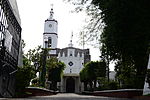
The Sierra de Guadalupe is a mountain range in Mexico. It is found between the borough of Gustavo A. Madero in northern Mexico City and the municipalities of Cuautitlán Izcalli, Tultitlán, Coacalco, Ecatepec and Tlalnepantla, in the State of Mexico. Its highest peak is at 3,055 meters (10,023 ft).
Excerpt from the Wikipedia article Sierra de Guadalupe, Mexico (License: CC BY-SA 3.0, Authors, Images).Sierra de Guadalupe, Mexico
Geographical coordinates (GPS) Address Nearby Places Show on map
 Continue reading on Wikipedia
 Geographical coordinates (GPS)
| Latitude | Longitude |
|---|---|
| N 19.583055555556 ° | E -99.116944444444 ° |
Address
San Andrés de la Cañada
07145
State of Mexico, Mexico
Open on Google Maps