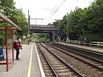
Chaussée de Waterloo

The Chaussée de Waterloo (French) or Waterloosesteenweg (Dutch), is a long north–south arterial road from Brussels to Waterloo, Belgium. It begins at the Halle Gate in the Brussels municipality of Saint-Gilles, continues a course towards the south-east until the Bascule area of Uccle, then turns south in the direction of Waterloo, where it changes its name to become the Chaussée de Bruxelles and continues in the direction of Genappe and Charleroi (Wallonia) until the regional border. Its length is 12.4 kilometres (7.7 mi) and its width between 15 and 18 metres (49 and 59 ft). Historically, the Chaussée de Waterloo was the main road from Brussels to Charleroi, crossing the Sonian Forest, and it remains one of the region's main arteries. The road crosses several districts, working class at its starting point in Saint-Gilles, but adorned with chic boutiques and restaurants as it progresses towards Waterloo, in particular in the Fort Jaco district in Uccle and in Waterloo itself. It is also home to many neoclassical, Art Nouveau and Art Deco town houses, and other historical buildings. It is served by TEC and De Lijn bus lines numbers 136, 137, and 365, which have replaced the local tram.
Excerpt from the Wikipedia article Chaussée de Waterloo (License: CC BY-SA 3.0, Authors, Images).Chaussée de Waterloo
Chaussée de Waterloo - Waterloosesteenweg,
Geographical coordinates (GPS) Address Nearby Places Show on map
Geographical coordinates (GPS)
| Latitude | Longitude |
|---|---|
| N 50.780277777778 ° | E 4.3816666666667 ° |
Address
Prince d'Orange - Prins van Oranje
Chaussée de Waterloo - Waterloosesteenweg
1180
Belgium
Open on Google Maps


