Dauntsey Vale
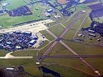
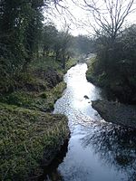
The Dauntsey Vale is a geographical feature in the north of the English county of Wiltshire. It is characterised by a wide, flat, clay floodplain of the upper reaches of the Bristol Avon river, which divides the Cotswolds to the west from the chalk downland of east and south Wiltshire. It is triangular in shape with its north edge running from the town of Royal Wootton Bassett in the east to Malmesbury in the west. This prominent north ridge is the setting for the village of Brinkworth, which at five miles long, claims to be the longest village in England. The western edge of the Vale is the edge of the Cotswolds, running from Malmesbury to Chippenham in the south. This edge is less pronounced than the classic escarpment which forms the western edge of the Cotswolds. It is characterised by a gradual drop in level, but more in the different building materials of the villages. For instance, Stanton St Quintin above the Vale has a distinct Cotswolds feel with the typical honey-coloured building stone and roof slates, while villages just a few miles away to the east like Christian Malford and Sutton Benger have typically thatched homes. The eastern edge of the Vale is more pronounced, with a steep and high hill forming a ridge running from Wootton Bassett in the north to close to Calne in the south. This ridge top provides the location for RAF Lyneham, the home until 2011 of the RAF's Hercules transport planes. It takes its name from the village of Dauntsey in the centre of the Vale.
Excerpt from the Wikipedia article Dauntsey Vale (License: CC BY-SA 3.0, Authors).Dauntsey Vale
Main Road,
Geographical coordinates (GPS) Address Nearby Places Show on map
Geographical coordinates (GPS)
| Latitude | Longitude |
|---|---|
| N 51.52 ° | E -2.02 ° |
Address
Main Road
Main Road
SN15 4DF , Christian Malford
England, United Kingdom
Open on Google Maps


