place

Christian Malford

Civil parishes in WiltshireEngvarB from August 2019LagerstättenOpenDomesdayPaleontology in the United Kingdom
Villages in Wiltshire
The Schoolhouse, Christian Malford geograph.org.uk 103511

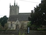
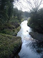
Christian Malford is a village and civil parish in the county of Wiltshire, England. The village lies about 4+1⁄2 miles (7 km) northeast of the town of Chippenham. The Bristol Avon forms most of the northern and eastern boundaries of the parish. The hamlets of Thornend and Upper Town lie within the parish. The unusual name is evidently a corruption of Christ mal Ford, Old English moel, mal being a mark: "Christ’s mal" is Christ's mark or sign, the cross. Thus the name signified "Cross Ford". Deeds from Glastonbury Abbey cartulary relate to Christmalford Manor: in AD 940 King Edmund granted Christmalford to St Dunstan, Abbot of Glastonbury. In 1086 the Abbey of Glastonbury remained tenant-in-chief of Cristemeleforee in the ancient Domesday hundred of Sterchelai (Startley). Christian Malford and the other parishes of Startley hundred were amalgamated with additional parishes to form the hundred of Malmesbury.

Excerpt from the Wikipedia article Christian Malford (License: CC BY-SA 3.0, Authors, Images).

Christian Malford
Lime Trees,

Geographical coordinates (GPS) Address Nearby Places
placeShow on map

Wikipedia: Christian MalfordContinue reading on Wikipedia

Geographical coordinates (GPS)

Latitude Longitude
N 51.507 ° E -2.053 °
placeShow on map

Address

Lime Trees

Lime Trees
SN15 4BN , Christian Malford
England, United Kingdom
mapOpen on Google Maps

The Schoolhouse, Christian Malford geograph.org.uk 103511
Share experience

Nearby Places

Dauntsey Vale

The Dauntsey Vale is a geographical feature in the north of the English county of Wiltshire. It is characterised by a wide, flat, clay floodplain of the upper reaches of the Bristol Avon river, which divides the Cotswolds to the west from the chalk downland of east and south Wiltshire. It is triangular in shape with its north edge running from the town of Royal Wootton Bassett in the east to Malmesbury in the west. This prominent north ridge is the setting for the village of Brinkworth, which at five miles long, claims to be the longest village in England. The western edge of the Vale is the edge of the Cotswolds, running from Malmesbury to Chippenham in the south. This edge is less pronounced than the classic escarpment which forms the western edge of the Cotswolds. It is characterised by a gradual drop in level, but more in the different building materials of the villages. For instance, Stanton St Quintin above the Vale has a distinct Cotswolds feel with the typical honey-coloured building stone and roof slates, while villages just a few miles away to the east like Christian Malford and Sutton Benger have typically thatched homes. The eastern edge of the Vale is more pronounced, with a steep and high hill forming a ridge running from Wootton Bassett in the north to close to Calne in the south. This ridge top provides the location for RAF Lyneham, the home until 2011 of the RAF's Hercules transport planes. It takes its name from the village of Dauntsey in the centre of the Vale.