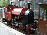
Abercorris quarry
CorrisCorris RailwayRailway inclines in WalesSlate mines in GwyneddUse British English from March 2018

The Abercorris quarry (also known as Cwmodyn quarry) was a slate quarry worked between the mid-1840s and the early 1950s. It was located at Corris Uchaf about 5 miles north of Machynlleth, in Gwynedd, north-west Wales. The quarry was connected to the Corris Railway via the Upper Corris Tramway which carried its products to the Cambrian Railways at Machynlleth for distribution. It worked the Narrow Vein.
Excerpt from the Wikipedia article Abercorris quarry (License: CC BY-SA 3.0, Authors, Images).Abercorris quarry
A487,
Geographical coordinates (GPS) Address Nearby Places Show on map
Geographical coordinates (GPS)
| Latitude | Longitude |
|---|---|
| N 52.6632 ° | E -3.8453 ° |
Address
Little Italy
A487
SY20 9RF , Corris
Wales, United Kingdom
Open on Google Maps


