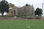
Nethercote, Banbury
BanburyHamlets in OxfordshireHarv and Sfn no-target errorsUse British English from March 2014
Nethercote is a hamlet on the edge of north Oxfordshire, a semi-rural area bordering with West Northamptonshire. The hamlet sits South East of J11 of M40, lying South of the A422 and East of the M40. Predominantly agricultural land used for grazing, a single-track road runs right through the hamlet, known as Banbury Lane, which has around a dozen residential properties along the lane. Banbury Lane is still often referred to as Blacklocks Hill and this refers to the history of the area and a time when this area saw a main route into Banbury, before the M40 and A422. In 1870-72 it had a population of 97.
Excerpt from the Wikipedia article Nethercote, Banbury (License: CC BY-SA 3.0, Authors).Nethercote, Banbury
Banbury Lane, Cherwell District
Geographical coordinates (GPS) Address Nearby Places Show on map
Geographical coordinates (GPS)
| Latitude | Longitude |
|---|---|
| N 52.0676 ° | E -1.305 ° |
Address
Banbury Lane
Banbury Lane
OX17 2BN Cherwell District
England, United Kingdom
Open on Google Maps


