Caleta de San Lazaro
Buildings and structures in HavanaHistory of HavanaStreets in Havana
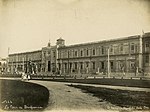
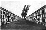
Arcabuco was the name of a footpath starting in Old Havana, in the vicinity of the church of Loma del Ángel, and ran in a westerly direction to an inlet cove of approximately 93 metres (305 ft) wide and 5.5 metres (18 ft) in depth. When Juan Guillén a Spanish soldier installed a carpentry shop to build small boats close to the cove the site became known as “La Caleta de Juan Guillén”, the road was known as “the caleta”. Eventually the Hospital de San Lázaro, the Espada Cemetery, the San Dionisio mental asylum, and La Casa de Beneficencia were developed in close proximity to the Caleta de San Lazaro.
Excerpt from the Wikipedia article Caleta de San Lazaro (License: CC BY-SA 3.0, Authors).Caleta de San Lazaro
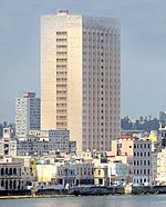
Malecón (Avenida de Antonio Maceo),
Geographical coordinates (GPS) Address Nearby Places Show on map
 Continue reading on Wikipedia
 Geographical coordinates (GPS)
| Latitude | Longitude |
|---|---|
| N 23.141832 ° | E -82.371513 ° |
Address
Malecón (Avenida de Antonio Maceo)
Malecón (Avenida de Antonio Maceo)
10340 (Cayo Hueso)
Havana, Cuba
Open on Google Maps