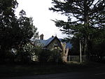
Mount Macedon
Mountains of Victoria (state)Use Australian English from January 2014

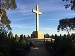
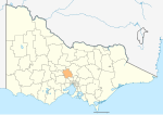
Mount Macedon ( MASS-ə-dən; Aboriginal Woiwurrung language: Geboor or Geburrh) is a dormant volcano that is part of the Macedon Ranges of the Great Dividing Range, located in the Central Highlands region of Victoria, Australia. The mountain has an elevation of 1,001 metres (3,284 ft) with a prominence of 643 metres (2,110 ft) and is located approximately 65 kilometres (40 mi) northwest of Melbourne.
Excerpt from the Wikipedia article Mount Macedon (License: CC BY-SA 3.0, Authors, Images).Mount Macedon
Bawden Road to Cameron Drive, Shire of Macedon Ranges
Geographical coordinates (GPS) Address Nearby Places Show on map
Geographical coordinates (GPS)
| Latitude | Longitude |
|---|---|
| N -37.383055555556 ° | E 144.57638888889 ° |
Address
Bawden Road to Cameron Drive
Bawden Road to Cameron Drive
3441 Shire of Macedon Ranges (Mount Macedon)
Victoria, Australia
Open on Google Maps
